Observation Date
2/14/2017
Observer Name
Zimmerman Wall
Region
Salt Lake » Little Cottonwood Canyon » Snowbird periphery
Location Name or Route
Upper AF Canyon/Miller Hill
Weather
Sky
Clear
Wind Direction
North
Wind Speed
Light
Weather Comments
Carbon copy of Monday. Cold start, warming throughout day. Winds started out moderate from NNE, trended to light by lunch, and back to moderate by late afternoon.
Snow Characteristics
New Snow Density
Low
Snow Surface Conditions
Powder
Faceted Loose
Melt-Freeze Crust
Snow Characteristics Comments
Continued faceting in top 10cms of snowpack. Surface hoar growing in sheltered meadows where trapped humid air remains or where there is a vapor source like a creek. Damp powder exists at highest elevations on solar aspects, but mostly a combo of crusts with radiation recrystalization taking place. Wind crusts are breaking down with diurnal temperature fluctuations.
Red Flags
Red Flags
Recent Avalanches
Red Flags Comments
Loose Dry still main activity observed. Loose Wet activity has subsided, but would still be leery of pockets around steep rock bands. Some slopes just off the highest ridgelines may have small wind slabs that would be sensitive to ski cuts.
Avalanche Problem #1
Problem
New Snow
Trend
Increasing Danger
Problem #1 Comments
Weaking of the snow surface continues. These cohesion-less sluffs get going with minimal provocation and run quite a ways, either on a semi frozen rain crust or within density changes in the new snow depending on elevation. This is likely going to get worse before it gets better.
Avalanche Problem #2
Problem
Wet Snow
Trend
Same
Problem #2 Comments
Still very warm in the sun, and there are wet loose avalanches on every slope steeper than 35 degrees that receives any solar input. Predictable timeframes of late morning through early afternoon depending on aspect.
Comments
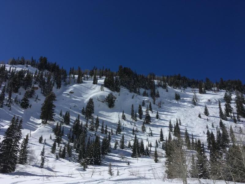
Photo 1: skier triggered Loose Dry on Miller Hill Northeast
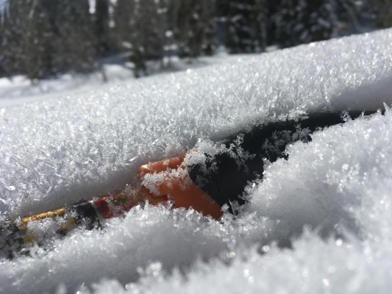
Photo 2: Surface hoar growth in low meadows (2 to 3 mm)
Photo 3: Wet activity on low elevation Northeast faces of upper AF canyon
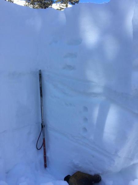
Photo 4: Rain crusts from 2/10 down 35cm and early Feb down 70cm. Total HS is 340 at 9500' in sheltered areas of upper AF. CTH BRK down 25cm on graupel above crust.
Today's Observed Danger Rating
Moderate
Tomorrows Estimated Danger Rating
Low