Observation Date
2/13/2017
Observer Name
Dave Garcia
Region
Moab
Location Name or Route
Laurel Highway/Upper Horsecreek
Weather
Sky
Scattered
Wind Direction
Northeast
Wind Speed
Strong
Weather Comments
Winds were the big story with the weather today. They have changed direction since yesterday and are blowing out of the North East. At low elevation they were light, but on the ridge line they were constantly moderate with very strong gusts. Low elevation temperatures were warm, but it stayed cold at and above tree line today.
Snow Characteristics
Snow Surface Conditions
Powder
Snow Characteristics Comments
As mentioned above, temperatures at and above tree line stayed cold and the new storm snow is holding up very nicely. Snow on NE aspects is nice, cold powder, and should remain that way tomorrow.
Red Flags
Red Flags
Wind Loading
Red Flags Comments
Strong winds out of the NE today were loading slopes facing South and West. I watched fresh drifts form on these slopes as the morning progressed to the afternoon. By the afternoon the fresh drifts were cracking under my feet on upper elevation ridge lines. Sunday we had moderate winds out of the SW, so tomorrow I would be on the lookout for fresh wind drifts on all aspects at Upper Elevations.
Avalanche Problem #1
Problem
Wind Drifted Snow
Trend
Same
Problem #1 Comments
I see two main avalanche problems out there right now. The first being wind slab in upper elevations. Wind Slabs on slopes that face North through East are high on the slopes and seemed to be confined to just below ridge lines and cornices, making them somewhat easy to manage. Tomorrow you will find fresh wind slabs on the other half of the compass due to today's strong NE winds. These new wind slabs on slopes facing West trough South should be more sensitive to triggers tomorrow than the older drifts on slopes facing North and East. There was plenty of snow available for transport today, and big plumes were coming off the high peaks all day long.
Avalanche Problem #2
Problem
New Snow
Trend
Same
Problem #2 Comments
The second avalanche problem right now is loose dry activity. Temperatures in the high elevations were cold today, and the cold north winds are keeping the snow cold and dry. This problem is pretty manageable and will be isolated to steep terrain facing North and East. I was able to get into some steep terrain today and experienced a good deal of sluffing on slopes approaching 40 degrees. Some of these sluffs were long running (several hundred feet) and required good sluff management techniques. If you find yourself getting into bigger terrain facing north or east, be aware that the snow could start moving on you, and consider what is beneath you.
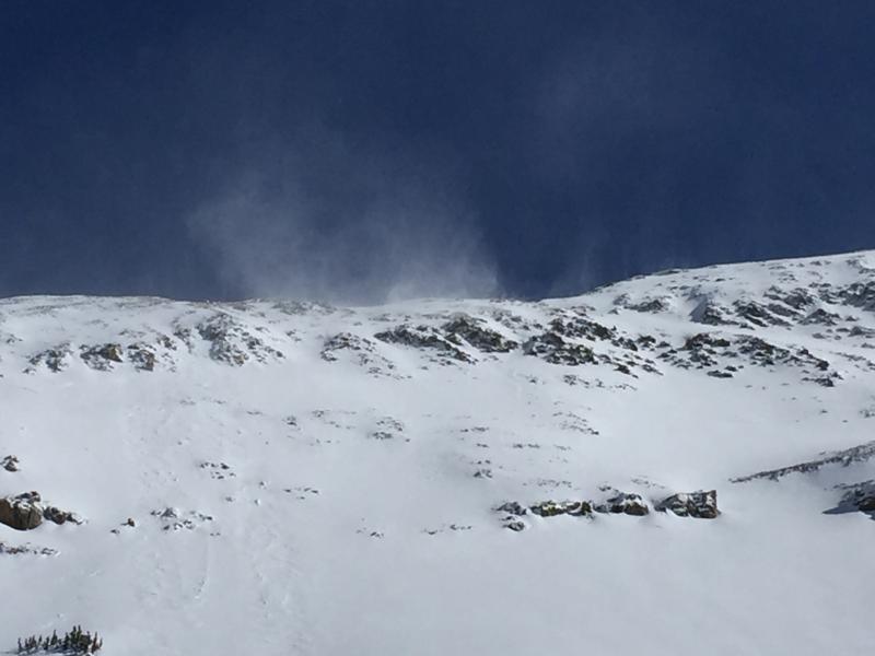
Big plumes of snow seen blowing off the ridge lines today. Those aren't clouds above that ridge...
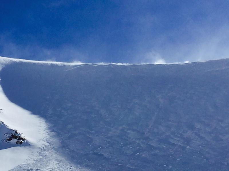
Another look at Eric's cornice triggered Wind Slab avalanche in Upper Horsecreek. On the left side of the picture you can see the right flank of the avalanche. You can see how the slab was confined to just beneath the ridge line. The crown was about a foot deep, follow the right flank, and you can see the slab quickly pinches out to nothing over a distance of about 30 feet.
Today's Observed Danger Rating
Moderate
Tomorrows Estimated Danger Rating
Moderate