Observation: Upper Weber Canyon

Observation Date
2/7/2017
Observer Name
Kikkert
Region
Uintas » Upper Weber Canyon
Location Name or Route
Upper Weber Canyon
Weather
Sky
Obscured
Precipitation
Moderate Snowfall
Wind Direction
Southwest
Wind Speed
Strong
Weather Comments
Winds were the main highlight today, strong from the SW and W all day, including in mid elevation terrain. Snowfall was light to moderate in the AM, heavy for an hour or two around noon, dying off late afternoon. Temps were warm, upper 20's to around freezing.
Snow Characteristics
New Snow Depth
8"
New Snow Density
Medium
Snow Surface Conditions
Powder
Snow Characteristics Comments

There was 4" from yesterday and overnight, and we added another 4" during the day. Denser snow with lots of small graupel.

Red Flags
Red Flags
Recent Avalanches
Wind Loading
Red Flags Comments
Main red flag was the wind.
Avalanche Problem #1
Problem
Wind Drifted Snow
Problem #1 Comments

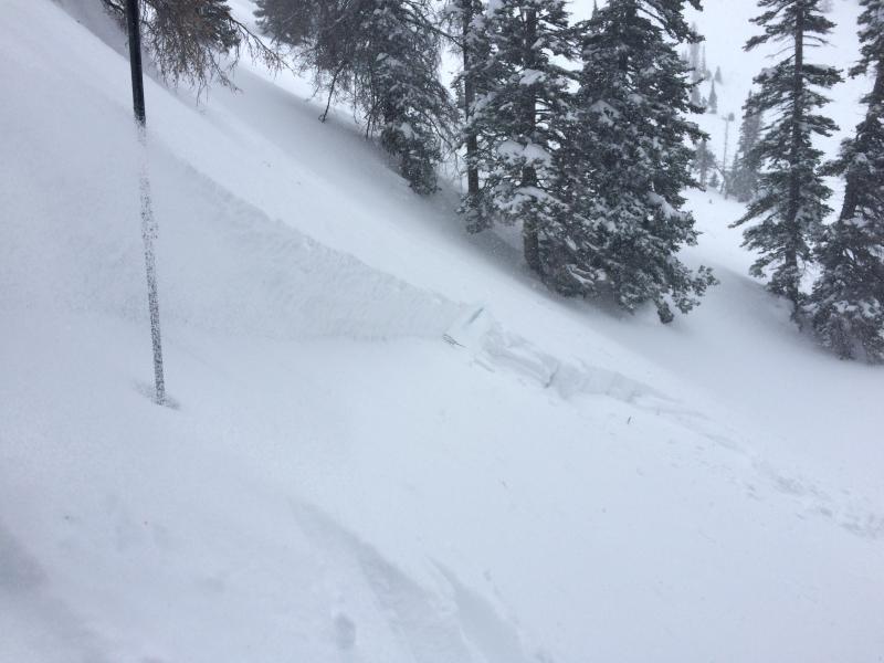
Lots of easily triggered wind slabs along mid-elevation ridgelines. Didn't venture into the upper elevations due to high winds. Wind slabs ranged from 6" to over 2' deep. See separate avalanche observation.

Avalanche Problem #2
Problem
Persistent Weak Layer
Trend
Same
Problem #2 Comments

Outside of wind zone, was noticing that there was beginning to be just enough snow to ski cut small pockets that were failing on faceted snow formed around a wind crust last week. In tests, we could not get propagation as there was not quite enough of a slab, but with settlement tomorrow and a bit more snow things may become more connected. See snow profile and photos below.

Snow Profile
Aspect
Northeast
Elevation
9,600'
Slope Angle
39°
Today's Observed Danger Rating
Considerable
Tomorrows Estimated Danger Rating
Considerable