Our Fall Auction is LIVE! Support avalanche forecasting by bidding TODAY! Ends Sept 26th.

Observation: Park City Ridgeline

Observation Date
2/7/2017
Observer Name
mark white
Region
Salt Lake » Park City Ridgeline
Location Name or Route
PC Ridgeline
Weather
Sky
Overcast
Precipitation
Light Snowfall
Wind Direction
Southwest
Wind Speed
Strong
Weather Comments
Warm, wet and windy are the three words that best describe today. Wind wasn't too bad down low in the drainage but as soon as you left the wind protected terrain the wind was howling from the SW in the strong catagory moving large amounts of snow to the leeward side of the high ridge line and loading the slope farther down the hill than usual, I could see large windpillows mid slope in many areas. There was also light graupel going on most of the day, but not adding up to a whole lot by the time I left at 3pm.
Snow Characteristics
New Snow Depth
6"
New Snow Density
High
Snow Surface Conditions
Dense Loose
Damp
Snow Characteristics Comments

The snow on all aspects was damp below 8000ft, with the rain line reaching 7800ft mid day, The snow in the wind protected terrain was upside down and inverted and made for some difficult trail breaking, in the exposed windward terrain it was supportable wind slab or scoured down to old crusts and dirt, on the high N where the wind was loading the slopes the snow was deep, thick and inverted not a great combo.

Comments

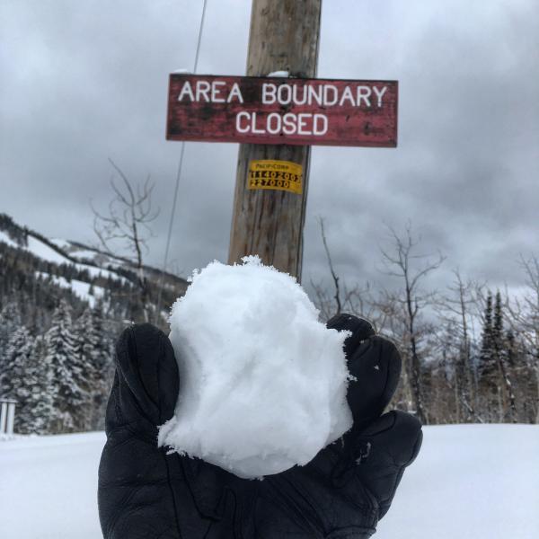
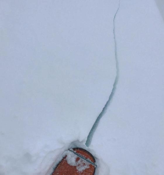
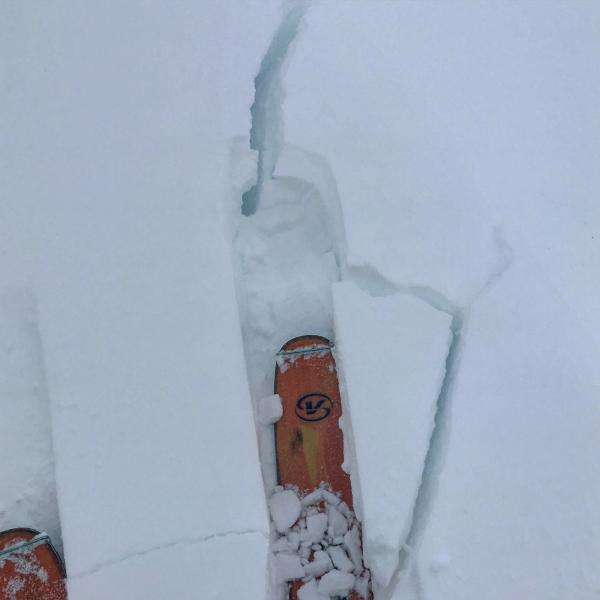
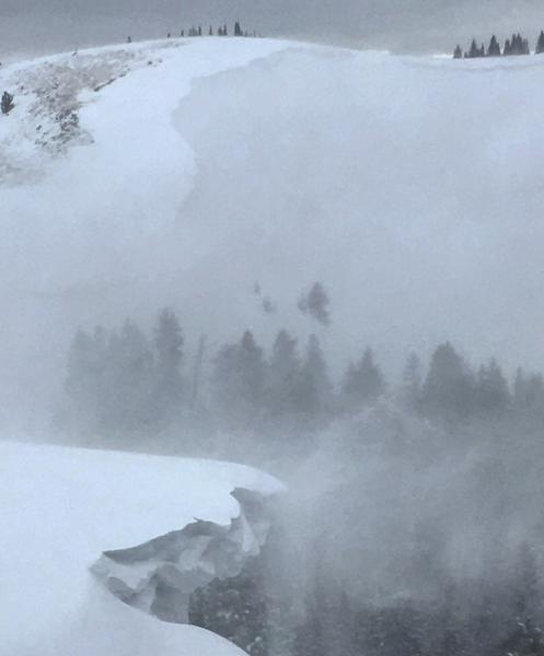
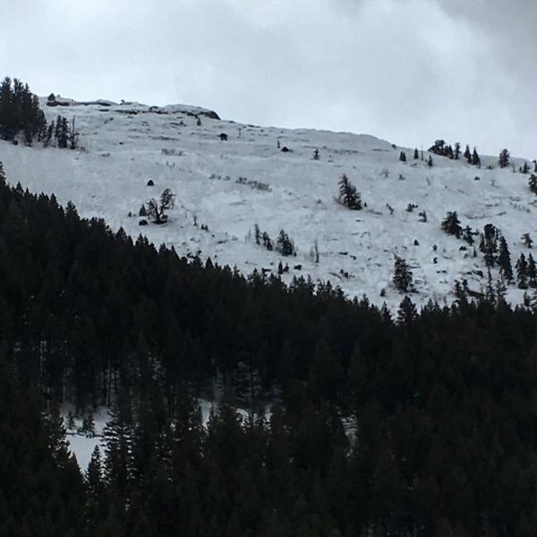
Headed up to the PC Ridgeline to see what the storm was doing, It was raining in the lower parking lot of Solitude when I arrived but graupeling in the upper lot. The snow was damp up to at least 8000ft and making a tight icy snowball was easy. Mid elevation was inverted, upper elevation was scoured. Took a look into Scott's which had a natural avalanche in it that I put on the avy page, No Name, and South Monitor all these north facing slopes were getting heavily wind loaded but Scott's was the only one with sighs of avalanching. I was getting cracking in the wind drifted snow but did not experience any collapsing. Some of the cornices are getting about as big as they get in these parts and I stayed quite a distance back from them, in these warm windy storms they become unpredictable and may break way farther back than expected. I also noted large wet avalanche debris piles in the bottoms of the Power House Couloirs

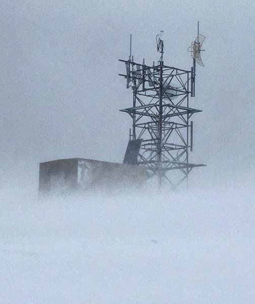
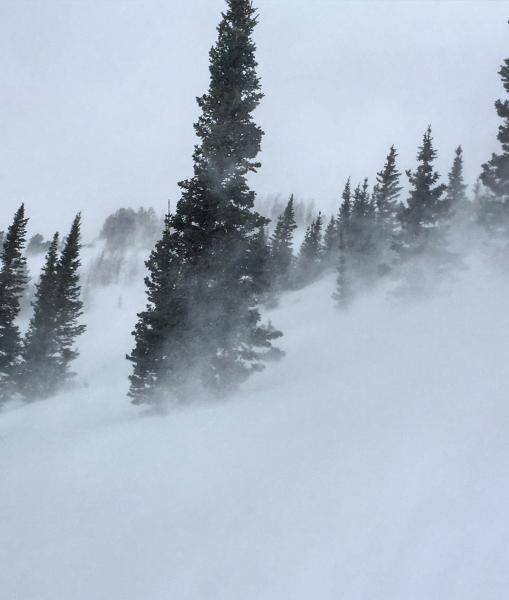
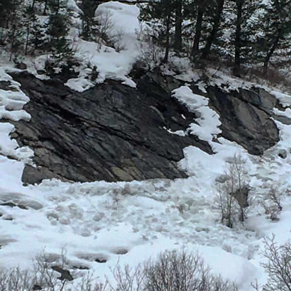
Photos:damps snow around 7600ft, cracking on the ridge line, extra large and overhanging cornice, wind blasting from the SW all day, wet activity on the rock slabs down canyon.

Today's Observed Danger Rating
Considerable
Tomorrows Estimated Danger Rating
Considerable