Observation: Cardiff Fork

Observation Date
2/3/2017
Observer Name
mark white
Region
Salt Lake » Big Cottonwood Canyon » Cardiff Fork
Location Name or Route
Cardiff Fork
Weather
Sky
Overcast
Precipitation
Light Snowfall
Wind Direction
Southwest
Wind Speed
Moderate
Weather Comments
Overcast skies most of the day with a few rare breaks of sun, moderate to strong winds out of the S-SW on the upper ridge line, not bad down in the drainage, light snowfall or I should say graupel fall during the day adding up to maybe a inch.
Snow Characteristics
New Snow Depth
3"
New Snow Density
Low
Snow Surface Conditions
Dense Loose
Wind Crust
Melt-Freeze Crust
Damp
Snow Characteristics Comments

Dense and creamy in upper elevation wind protected terrain, damp on most aspects at lower elevations. The couple inches of new snow was just some lipstick on a pig for the tracked up wind hammered upper regions of Cardiac, and the stout melt-freeze crust on the S end of the compass. Raised tracks could be seen on E,W and N where the wind had scoured the slopes.

Red Flags
Red Flags
Wind Loading
Red Flags Comments
Only red flag today was wind loading but the wind load was not making it down in the drainage very far so only the upper ridge lines and just down from them were affected, and easily managed with ski cuts.
Comments

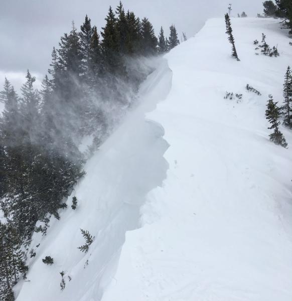
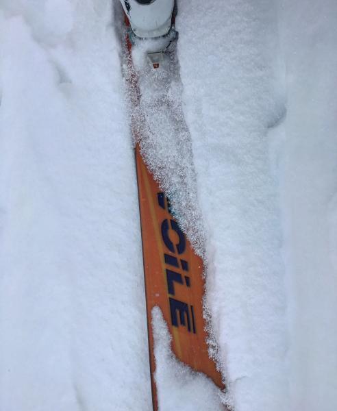
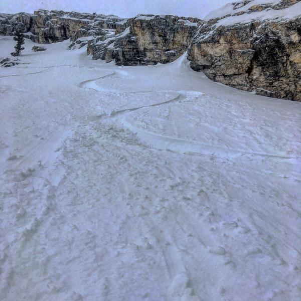
Headed into Cardiff from the Alta side hoping the wind had smoothed things out and the new snow would soften the ride, the wind had smoothed things out but the new light density snow was not much of a buffer from the hard surfaces underneath. I was getting cracking in the newly formed wind drifts on the ridge line but these drifts were fairly shallow and not packing much of a punch. Cornices were growing on top of the old frozen cornices from previous wind events and they were quite sensitive but not that large in the scope of things. Sluffing seemed a little less active today than yesterday I think it might have to due with the warmer air temperatures. Most of the new snow that fell today was in the form of graupel and it was actively running down the slopes to less steep terrain, and doing a better job of filling in old tracks than was the light density snow from yesterday. I would say that the biggest concern for tomorrow will be wind slabs on steep hard icy slopes or steep slopes with a firm wind board on them. In the wind sheltered terrain even on steep slopes the new snow seemed well bonded and not a real issue unless we get a large dose of new snow and wind over night.

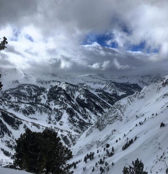
Photos: wind loading and cornice growth on the high ridge line, storm pushing in from the SW in the AM, graupel from today, minor sluffing in wind protected high elevation terrain.

Today's Observed Danger Rating
Moderate
Tomorrows Estimated Danger Rating
Moderate