Observation: Red Pine Gulch

Observation Date
1/28/2017
Observer Name
AT
Region
Salt Lake » Little Cottonwood Canyon » Red Pine
Location Name or Route
Red Pine
Weather
Sky
Clear
Wind Direction
Northeast
Wind Speed
Moderate
Weather Comments
Warming quite a bit by early afternoon, wind was fairly strong up high.
Snow Characteristics
New Snow Depth
6"
New Snow Density
Medium
Snow Surface Conditions
Powder
Dense Loose
Damp
Snow Characteristics Comments
Good powder down low early, getting heavier as the day went on, wind buffed higher on some of the ridges, probably loading on other aspects.
Red Flags
Red Flags
Recent Avalanches
Rapid Warming
Red Flags Comments
Still have the buried SH on the radar, tried to stay out of wind loaded areas up high today. Could also see some activity in the afternoons on sun affected slopes.
Avalanche Problem #1
Problem
Persistent Weak Layer
Trend
Same
Problem #1 Comments
Dug on a N facing slope at 9800 ft and didn't find the buried weak layer, weakest layer was a small amount of graupel down about 3 feet but didn't shear easily or with much energy.
Avalanche Problem #2
Problem
Wet Snow
Trend
Same
Problem #2 Comments
With warming we saw some sluffs releasing under rocks and on steep west facing slopes.
Comments
Skiing was overall pretty good today, nice to be out in the sun. Winds cranking up high and some loose activity by early afternoon.
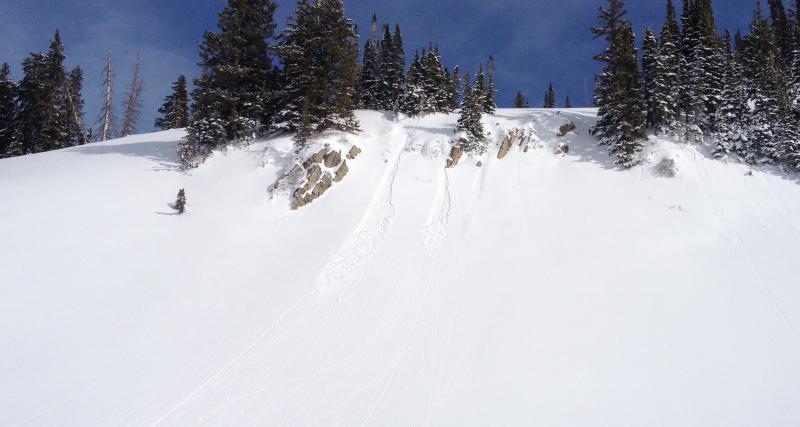
Loose point releases on west facing at about 1pm
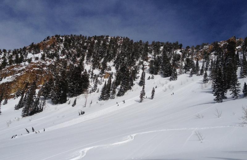
Small loose Avalanche off the west facing side of Rainbow Peak. Couldn't see starting zone. Probably occurring mid day
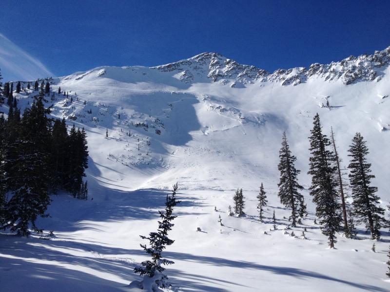
Old Avalanche on Lake Shot below No Name Baldy, same as reported earlier but photo with some sun. Likely happened during the storm last week or just after.
Today's Observed Danger Rating
Moderate
Tomorrows Estimated Danger Rating
None
Coordinates