Observation: Cardiff Pass

Observation Date
1/25/2017
Observer Name
Tyler Falk
Region
Salt Lake » Little Cottonwood Canyon » Cardiff Pass
Location Name or Route
Cardiff Pass
Weather
Sky
Obscured
Precipitation
Light Snowfall
Wind Speed
Calm
Weather Comments
Scattered clouds in the lower canyon with obscured skys in the upper half of LCC with S1 snowfall throught the afternoon. Upper LCC picked up four inches of new low denisty snow durring the day today. Calm winds on 10k ridgelines this afternoon with temps hovering around 8 degrees.
Snow Characteristics
New Snow Depth
4"
New Snow Density
Low
Snow Surface Conditions
Powder
Snow Characteristics Comments

Well with the new snow on top of our existing storm snow its back to right side up which is making for amazing ridding conditions. Not much transport of the new low density snow today. Looks like winds will be relatively minimal the next 48 hours but something to keep a eye on if the forecast does not verify and they do pick up. No result from a few dropped cornices. Evidence of winds under the light density new snow from the South, West & North West above 9500. A few density changes in the storm snow. On steeper rollovers 50cm storm slabs were trying to break out. Ski penetration on the way up was around that same depth. Snowbird snowtel site up to 192% of median.

Red Flags
Red Flags
Recent Avalanches
Heavy Snowfall
Cracking
Poor Snowpack Structure
Red Flags Comments
Plenty of red flags to keep me off the big terrain today. A siginifant load of 3" of moisture in the last few days in upper LCC, cracking and a poor snowpack structure in many locations.
Avalanche Problem #1
Problem
New Snow
Trend
Decreasing Danger
Problem #1 Comments

Although loosing energy there are still storm slabs out there that I am sure could be active into tomorrow. They possibly could step down into deeper avalanches.

Avalanche Problem #2
Problem
Persistent Weak Layer
Trend
Same
Problem #2 Comments

Persistent slabs breaking on faceted or buried surface hoar will be deep unmanageable avalanches. I would guess that most of these are going to be outside of upper LCC & BCC. For example the slide on Mt. Aire today and the UOP slide Andy reported, both outside the central cottonwoods. I would suspect lower elevations might also be a place where you could find trouble even in the cottonwoods.

Comments

Evidence of avalanches in the Y, Little Pine, White Pine and Superior.

There have been 23 storms with over 6" of snow at Alta this year with an average density this season of 10.21% Lots of snow, surface and near surface surface instabilities and direct action avalanches have been more frequent than persistent weak layers this year. There have been a few rain events earlier this season at 8k, many locations now have a 3 meter deep snowpack...trending towards maritime??

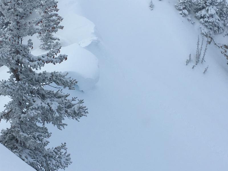
Pic. 1. Large cornices

Pic 2. I did not even need to leave my neighborhood to see signs of avalanche activity.

Pic 3. Evidence of a D3 avalanche..."can damage a truck" or in this case the Hellgate Condo Van

Today's Observed Danger Rating
Considerable
Tomorrows Estimated Danger Rating
Considerable