Observation: Neffs

Observation Date
1/21/2017
Observer Name
Greg Gagne with Patrice Duvernay
Region
Salt Lake » Neffs
Location Name or Route
Neffs Canyon
Weather
Sky
Obscured
Precipitation
Moderate Snowfall
Weather Comments
Occasional periods of heavy snowfall.
Snow Characteristics
New Snow Depth
16"
New Snow Density
Low
Snow Surface Conditions
Powder
Snow Characteristics Comments

Beautiful, over-achieving storm! Am especially excited to see the return of the low elevation snowpack.

Red Flags
Red Flags
Recent Avalanches
Heavy Snowfall
Cracking
Collapsing
Poor Snowpack Structure
Red Flags Comments
Widespread cracking and collapsing, natural avalanches, remotely triggered avalanches, as well as avalanches releasing symathetically. Lots of snow in a short period of time. Not the largest or most dangerous, but probably the most sensitive avalanche conditions I have seen since 2012. (Which, coincidentally, occurred on Jan 21, 2012.)
Avalanche Problem #1
Problem
New Snow
Trend
Increasing Danger
Problem #1 Comments

Very easy to trigger avalanches this afternoon on test slopes. We saw evidence of natural avalanches, and could get a failure as we even approached a steeper test slope. We avoided all avalanche terrain, and kept far back from avalanche runout zones. Even smaller slopes were leaving decent-sized debris piles.

Largest avalanche we triggered was above a steep-sided gully (the gully bottom is a terrain trap). Approaching the top I tapped on the snowpack and the slide ran 25' to the gully bottom. It sympathetically released an avalanche on the other side of the gully that went up the other side and 100' across.

These slides were either breaking within the storm snow, or at the interface of the Thursday Jan 19 snow that had a layer of low-density stellars that others have also reported as being sensitive. Slides were 30-40 cms (12-16") and very soft.

Comments

Once the current storm winds down, I imagine the natural activity will quickly cease, but I am thinking human triggered slides will remain possible/likely as the weak layer of low density stellars as well as buried facets (and possibly surface hoar in some isolated spots) will remain sensitive. With winds forecasted to increase, and well as additional snowfall, by mid-day Sunday we won't get much of a break from dangerous avalanche conditions for at least the next several days.

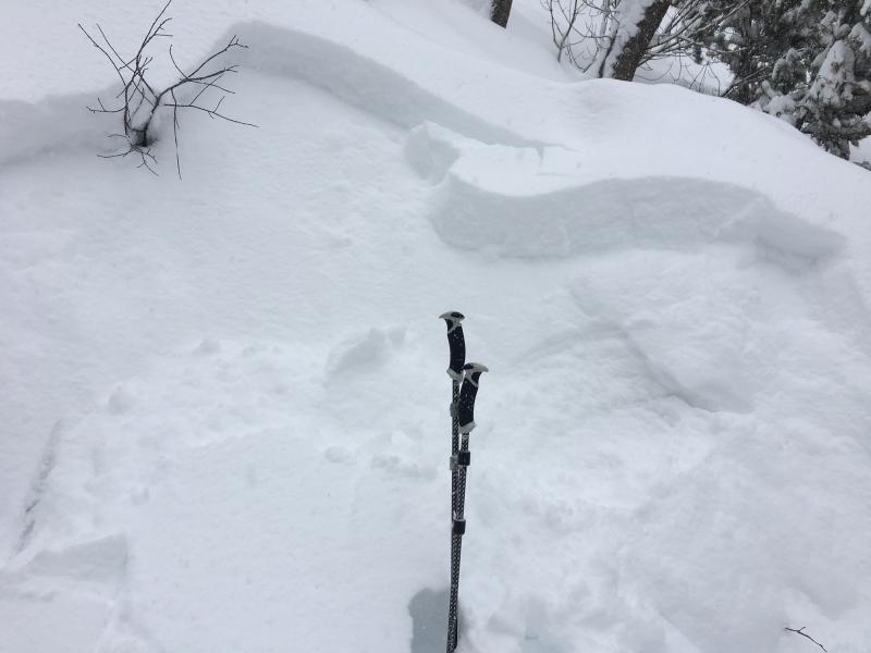
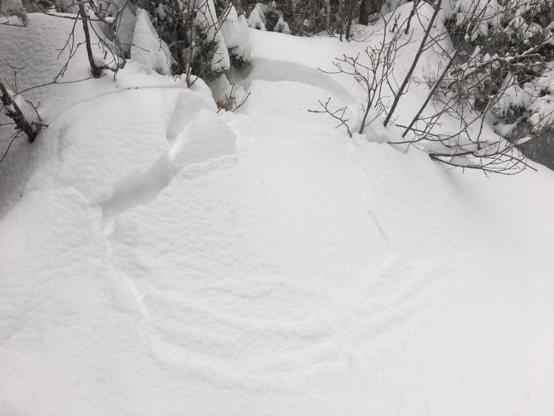
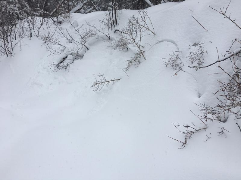
In-your-face instability this afternoon meant staying off of and well away from avalanche terrain. Photos and video show cracking and small avalanches on test slopes.

Video
Today's Observed Danger Rating
High
Tomorrows Estimated Danger Rating
High