Observation Date
1/20/2017
Observer Name
Dustin
Region
Salt Lake » Big Cottonwood Canyon » Silver Fork
Location Name or Route
Silver Fork
Weather
Sky
Broken
Precipitation
Light Snowfall
Wind Direction
South
Wind Speed
Light
Weather Comments
Route today was Brighton>Twin Lakes>East Bowl>Flanagan's. Brief period of sun around noon followed by steady light snow and light winds out of the South until my exit out Silver Fork Canyon around 3:00.
Snow Characteristics
New Snow Depth
6"
New Snow Density
Low
Snow Surface Conditions
Powder
Snow Characteristics Comments
Around 6 inches of pretty light density snow sitting on a variety of old snow surfaces...firm crust on the southerlies and west/mixture of pretty rotten surface snow and old tracks on most N aspects. We should probably add "Tracks" to the snow surface conditions list. I dug several quick pits on a variety of mostly sheltered NE/N/NW aspects between 8500 and 10k feet and did not note any preserved surface hoar, although as my buddy pointed out today, the new snow was so light and fluffy that it was kind of hard to identify any lingering SH underneath it...at least for me. New snow was pretty predictable and seemed to have fallen pretty much straight out of the sky overnight, although sluffing was common on any slope around 40 degrees or steeper.
Avalanche Problem #1
Problem
New Snow
Trend
Increasing Danger
Problem #1 Comments
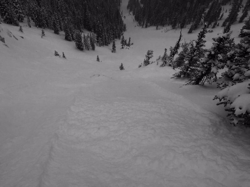
As I said sluffing was widespread on the steeper slopes today. For me the new snow would run on most slopes around 40 degrees and up...I wasn't able to initiate anything that I thought would bury you, but I would not have ruled out getting knocked off your feet in places. The new snow was actually quite a bit better behaved on the N half of the compass than the S, having appeared to be poorly bonded to the sun crusts beneath. Sluffs on the southerlies although still small were more energetic during my travels today. Would expect lee slopes to be pretty reactive in the new snow tomorrow if we get some wind.
Sloughing on ~40 deg NW slope. Think Greg's forecast was right on for today and that if we get much wind overnight the new snow will be quite a bit more reactive tomorrow. Doesn't look like much of a load too quickly over the next few days but the new snow from last night/today is pretty easily transported.
Today's Observed Danger Rating
Low
Tomorrows Estimated Danger Rating
Moderate