Our Fall Auction is LIVE! Support avalanche forecasting by bidding TODAY! Ends Sept 26th.

Observation: Upper Weber Canyon

Observation Date
1/19/2017
Observer Name
Kikkert
Region
Uintas » Upper Weber Canyon
Location Name or Route
Upper Weber Canyon
Weather
Sky
Obscured
Precipitation
Light Snowfall
Wind Direction
Southwest
Wind Speed
Moderate
Weather Comments
Light snowfall through the day, adding up to 2" by 4pm. Winds were in the 30s along the exposed ridges from the SW until about 2 pm, when they went more westerly and became light.
Snow Characteristics
New Snow Depth
2"
New Snow Density
Low
Snow Surface Conditions
Powder
Faceted Loose
Avalanche Problem #1
Problem
Wind Drifted Snow
Problem #1 Comments

Overall, not too many current avalanche problems to deal with. The snowpack in most places is deep and homogenous. Amazingly so. There is, however, weak snow from this weeks clear cold nights that is now buried. For the most part today there wasn't enough new snow on top to be a problem. However, in wind affected terrain there was just enough for some sensitive shallow soft slabs in steep terrain that gets a lot of windloading.

Avalanche Problem #2
Problem #2 Comments

The winds really didn't blow that hard before snow started, and calmed down in the afternoon. By 2 pm the snow was falling straight out of the sky. As a result, the near surface facets and surface hoar that were formed this week were preserved intact on many slopes. Regarding the NSF, it didn't look like they were very well developed or overly weak where we were today, but time will tell how weak they turn out to be. Regarding the surface hoar, I found preserved surface hoar up to 9,800' on a N facing slope. It was hard to find as it is mixed in with the light density snow. Again, time will tell if enough was preserved to cause problems, but its worth keeping an eye on as the snow stacks up beginning of next week.

Comments

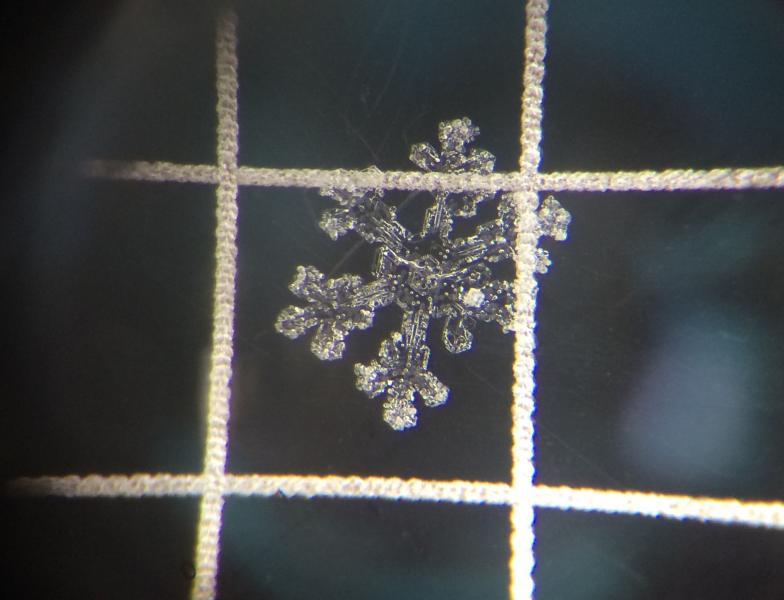
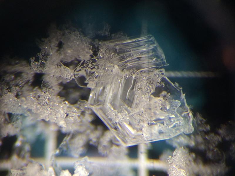
Photos below are of stellar-dendrites from the snow surface at 9,800' on a N facing slope, and of surface hoar at the same location, now preserved below the new light density snow. Grid in photos is 3mm.

Today's Observed Danger Rating
Low
Tomorrows Estimated Danger Rating
Moderate