Observation Date
1/13/2017
Observer Name
Zimmerman Wall
Region
Salt Lake » Little Cottonwood Canyon » Snowbird periphery
Location Name or Route
Sinners Pass/Mary Ellen Gulch
Weather
Sky
Obscured
Precipitation
Light Snowfall
Wind Direction
South
Wind Speed
Calm
Weather Comments
In upper AF canyon the sun never made an appearance until after 15:00. Cloud deck was moving between 10,000 and 10,500 feet. Barely a trace of wind and the snowfall periods topped out at S minus 1 at various intervals throughout the day. Lots of snow still on the trees canyon wide. Temps were very comfortable, coming in at just under freezing at noon.
Snow Characteristics
New Snow Depth
6"
New Snow Density
Low
Snow Surface Conditions
Powder
Snow Characteristics Comments
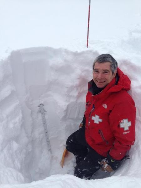
Very light density snow of the blower variety capped off yesterday's snowfall. Premium powder conditions on a supportable base made the skiing excellent on every aspect we visited around the compass.. The medium density snow from the beginning of the storm cycles has filled in a lot of terrain and upper AF canyon is as deep as I have seen it. 3 meters was measured at our study plot at 9700' on N. facing Sinner's Pass. 165cm of that has come since January 1st, and 85cm of that has come since January 8th. The snow is quite well bonded sluffs were not running as far as expected.
Red Flags
Red Flags
Recent Avalanches
Heavy Snowfall
Red Flags Comments
Naturals were visible on several aspects in the steepest terrain we could get our eyes on. These appear to have ran during the storms at the beginning and middle of the week.
Avalanche Problem #1
Problem
New Snow
Trend
Decreasing Danger
Problem #1 Comments
At a majority of the locations we visited there was 6" of snow covering everything and it would have been hard to tell if windslabs were present, so went with storm slab as the primary problem. Explosives triggered releases on the Snowbird periphery had uniform crown depths and storm slab characteristics, running on density changes within the storm snow. Graupel layers were also present in the upper 80cms of the pack and the deepest were quite well preserved. These layers were reactive in shear tests and CTs, but no propagation occurred during ECT or PST. The previously occurring naturals we did see had been covered by some new snow and had very soft debris. Don't get me wrong, I know the wind was blowing hard during the beginning of the week, but we just couldn't find any wind slabs on the upper elevations ridges we visited.
Avalanche Problem #2
Problem
Cornice
Trend
Same
Problem #2 Comments
As mentioned in my previous post, there are some monsters out there. With expected clearing and rising temps to above freezing, I still think these are a major concern. Traveling along ridgelines it is easy to get lured out onto one of these, and although they aren't as sensitive as Tuesday, they should still be regarded as dangerous. That being said, I also feel that wet loose could be an issue tomorrow with the encroaching high pressure forecast. Green housing may also occur with the higher clouds.
Snow Profile
Aspect
North
Elevation
9,000'
Slope Angle
15°
Comments
Photos:
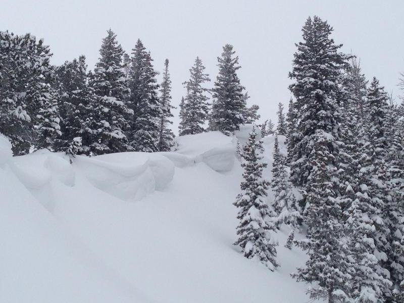
1. Cornices along 10K ridgelines
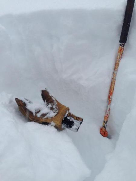
2. Graupel layers reactive on shear test
3. January Snowfall has been incredible (boards last cleared January 1st.)
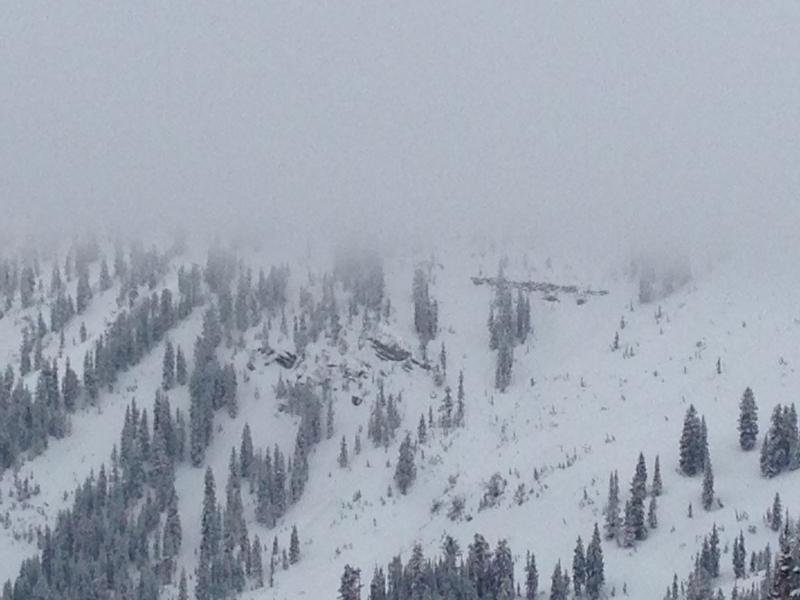
4. Natural avalanche in Y Not of Mary Ellen Gulch (Mid slope ~10k under cliff band, steep N facing terrain)
Today's Observed Danger Rating
Moderate
Tomorrows Estimated Danger Rating
Moderate
Coordinates