Planned Website Outage: The UAC website will be down for maintenance on June 17 from 2:00 - 7:00 PM MT.

Observation: Cutler Ridge

Observation Date
1/12/2017
Observer Name
kory and ben
Region
Ogden » Ben Lomond » Cutler Ridge
Location Name or Route
Cutler Ridge
Weather
Sky
Broken
Precipitation
Light Snowfall
Wind Direction
South
Wind Speed
Calm
Weather Comments
Calm dat
Snow Characteristics
New Snow Depth
20"
New Snow Density
High
Snow Surface Conditions
Powder
Snow Characteristics Comments

50 cms sitting on the rain crust from sunday/monday Jan 9/10

Red Flags
Red Flags
Recent Avalanches
Red Flags Comments
The new snow has really started to settle. Somthing very different for us here in utah but less than 24 hrs from the snow stop snowing I noticed lots of settlement and consolidation of new snow.
Avalanche Problem #1
Problem
Persistent Weak Layer
Trend
Decreasing Danger
Problem #1 Comments

I do not think this is the most likely to be triggered but It is the scariest. At the shallowest these slides were at 120 ish. These avalanches will really lure you out ont the slab before it is triggered.

Avalanche Problem #2
Problem
New Snow
Trend
Decreasing Danger
Problem #2 Comments

Storm Slab is still out there but will be settling quickly over the next few days.

Comments

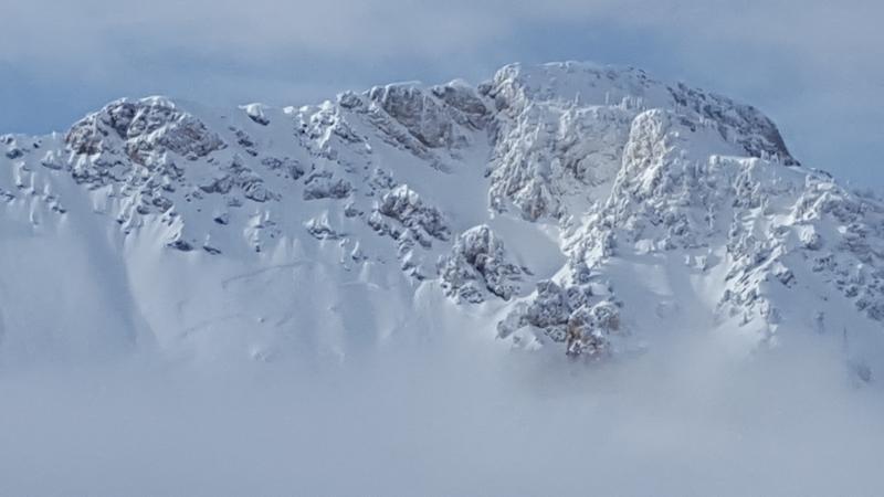
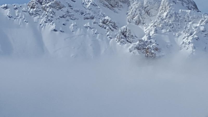
There was a R2 D3 avalanche off willard peak.

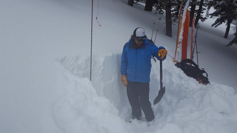
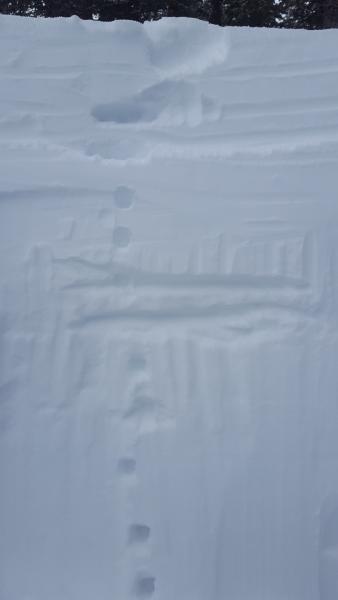
Total Hs 250 cms at 800 feet. 150 cms on top of dec 17 rain crust. EXTX x2

I really think we are close to Moderate at the higher elevations and Considerable below.

Today's Observed Danger Rating
Considerable
Tomorrows Estimated Danger Rating
Considerable