Our Fall Auction is LIVE! Support avalanche forecasting by bidding TODAY! Ends Sept 26th.

Observation: Upper Weber Canyon

Observation Date
1/11/2017
Observer Name
Kikkert
Region
Uintas » Upper Weber Canyon
Location Name or Route
Upper Weber Canyon
Weather
Sky
Obscured
Precipitation
Moderate Snowfall
Wind Direction
Southwest
Wind Speed
Strong
Weather Comments
Stuck below 9,500 ' due to winds, visibility, and the amount of new snow. Winds were getting down in to the lower elevations more than the last two days.
Snow Characteristics
New Snow Depth
22"
New Snow Density
Medium
Snow Surface Conditions
Powder
Snow Characteristics Comments

24 total at 9AM was 22 inches, with an additional 4 during the day. Totals since Sunday night are around 45 inches, settled to 35 inches. Total snow is at 8,700' is 78 inches. New snow was a bit inverted, which made for slow skiing.

Red Flags
Red Flags
Recent Avalanches
Heavy Snowfall
Wind Loading
Red Flags Comments
Biggest red flags are the shear amount of new snow coupled with the constant strong WSW winds. In the back of all our minds was the large natural from yesterday as well. That said, the overall snowpack structure is good, the new snow just needs a bit of time to settle out.
Avalanche Problem #1
Problem
New Snow
Problem #1 Comments

Tough to parse out the avalanche problems, since there are multiple. However, since we didn't venture into the wind zone, we were mostly dealing with storm slabs. With some prodding, we got one small pocket to pull out, 50' wide, 0.5 to 1.0 feet deep, except for one small spot where it stepped down 3 feet deep to the Sunday rain crust. Other prodding did not produce anything else. See photos below.

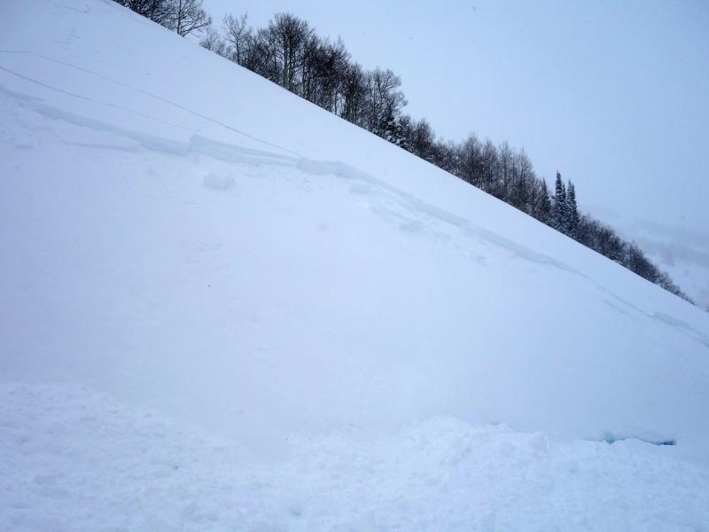
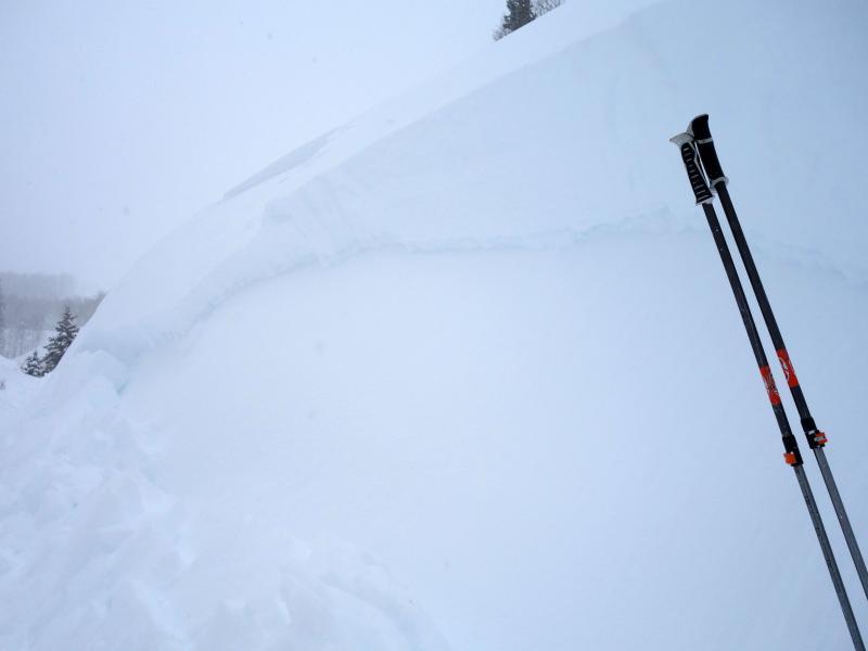
Today's Observed Danger Rating
High
Tomorrows Estimated Danger Rating
High