Observation Date
1/10/2017
Observer Name
Zimmerman Wall/Nason
Region
Salt Lake » Little Cottonwood Canyon » Grizzly Gulch
Location Name or Route
Twin Lakes Pass/Grizzly Gulch
Weather
Sky
Overcast
Precipitation
Light Snowfall
Wind Direction
Southwest
Wind Speed
Moderate
Weather Comments
OBS going to OVC. Very flat light made observations difficult for great distances. But could see the whole of LCC from the top of TLP. Winds were consistently moderate out of the SW gusting strong. Temps were quite comfortable and precip fluctuated from nil to S minus 1. (my minus sign doesn't work on here for some reason). By the time I exited the canyon at 1600, the snowfall had picked up to S1 and winds remained moderate/strong SSW.
Snow Characteristics
New Snow Depth
5"
New Snow Density
Medium
Snow Surface Conditions
Powder
Dense Loose
Wind Crust
Snow Characteristics Comments
From the lot at Grizzly Gulch to the top of TLP, we encountered mostly soft, supportable, right side up dense powder. On exposed terrain features and even the cat road there were some scoured patches, but the skiing was excellent on the aspects we visited. NW through S. Graupel was noticed in gullies and under cliff bands, but was capped with surfy snow. Coverage is incredible for early Jan. Seems like we are maybe 65cm more YTD over last season. And that extra bit is of the dense variety that builds excellent base.
Red Flags
Red Flags
Recent Avalanches
Heavy Snowfall
Wind Loading
Cracking
Red Flags Comments
Natural and explosives triggered avalanches were noted on the slow drive up the canyon. The one advantage of the uphill red snake is that it forces you to look around and observe your surroundings. I even opened the sunroof to look at some of the lower canyon slides on up through Scotties. Wind transport was obvious and the cornice development is impressive. Something inside me believes we are trending towards a maritime pack this season, which is better than the alternative I suppose. The instabilities we noted in the upper pack were centered around graupel and preserved precip particles. Believe that with continued wind and snow, danger may rise to high in the mid and upper elevations on leeward aspects.
Avalanche Problem #1
Problem
Wind Drifted Snow
Trend
Increasing Danger
Problem #1 Comments
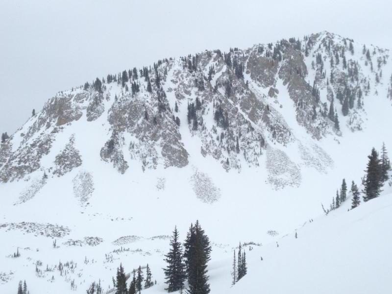
Top of the list again based on my observations throughout the day. Wind hasn't backed off and you can see pillows forming off ridgelines. Some small crossloaded tailings piles in lower Grizzly had evidence of natural activity. The explosives triggered slides from resorts and UDOT also had those characteristic variable crown depths of wind slab. Wind damage across the range was noticed from top of TLP. USA Bowl and Wolverine were stripped and crossloaded in interesting way.
Avalanche Problem #2
Problem
Cornice
Trend
Increasing Danger
Problem #2 Comments
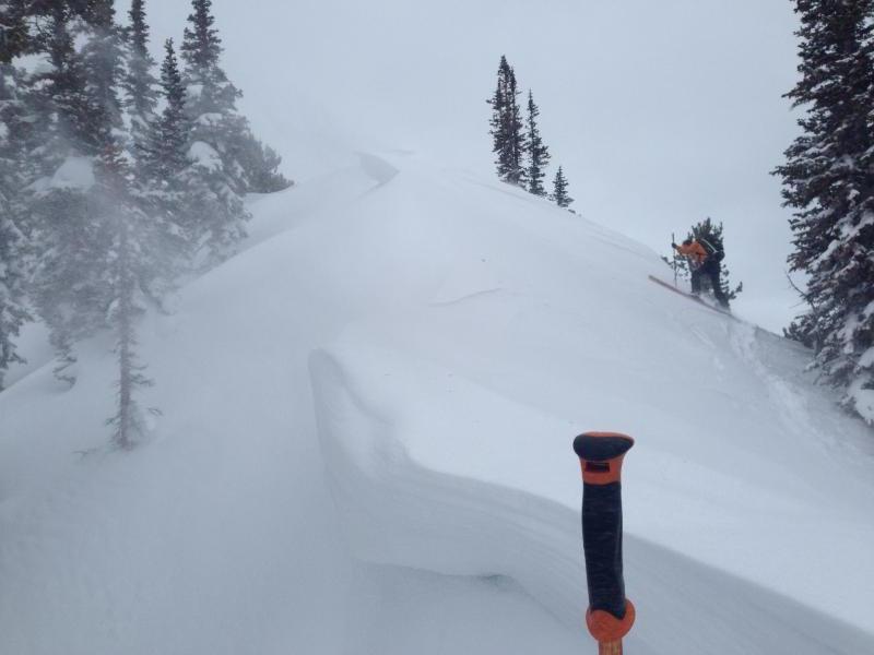
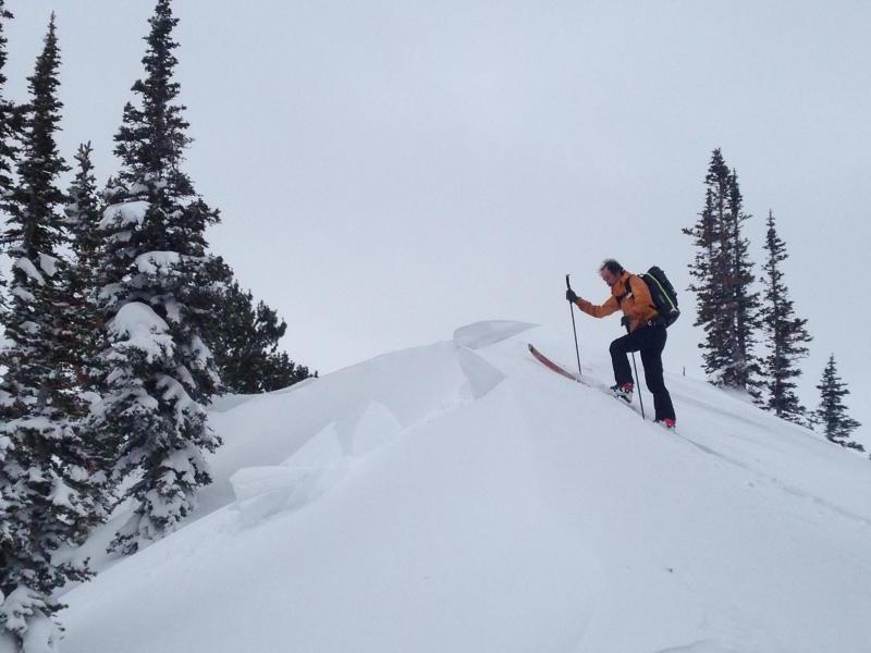
I think it is time this makes it into the forecast. Warm temps, high moisture content snow, and sustained wind have grown some monsters in the Wasatch. Many experienced pros have gone along merrily kicking them and getting some impressive sized chunks to break off. While I haven't heard of more than a few triggering subsequent avalanches, I do see these as an issue when traveling along ridgelines in flat light and reduced visibility. Today we triggered a small cornice on approach, and others were sensitive to aggressive pole whacking. The chucks stayed intact when hitting the slopes below. I had a particularly scary experience with a cornice in 2006 on the Alta Periphery that forced me to STFU and get educated.
Comments
Photos below are:
***I hope the upside down photo issue with the site is resolved by morning***
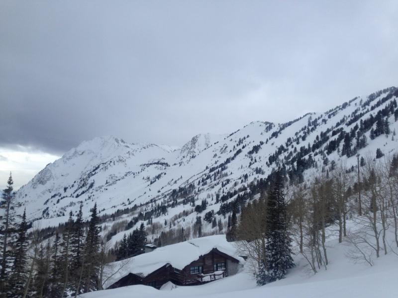
1. Upper LCC from lowest Patsey Marley ridge
2. Cornice development on lowest Patsey Marley Ridge
3. Sensitive cornice on the lowest Patsey Marley ridge
4. Wind crossloading lower flanks of Wolverine Cirque
Today's Observed Danger Rating
Considerable
Tomorrows Estimated Danger Rating
Considerable