Observation Date
1/10/2017
Observer Name
mark white
Region
Salt Lake » Little Cottonwood Canyon » Alta Periphery
Location Name or Route
Rocky Point, Alta Perimeter
Weather
Sky
Obscured
Precipitation
Moderate Snowfall
Wind Direction
Southwest
Wind Speed
Moderate
Weather Comments
Obscured skies, gusty SW winds and moderate snowfall above 10,000ft, not bad below that elevation, almost balmy at the bottom.
Snow Characteristics
New Snow Depth
4"
New Snow Density
High
Snow Surface Conditions
Dense Loose
Snow Characteristics Comments

Seemed like another 4 inches of dense snow mixed with graupel fell last night and early today, the snow was a bit lower density than yesterdays new snow due to a bit colder temperatures.

Red Flags
Red Flags
Recent Avalanches
Wind Loading
Cracking
Red Flags Comments
Lots of new avalanches triggered by Udot on the north side of road this morning, looked as if most of the mid and upper paths ran with explosives, but I didn't note much activity up past East Hellgate but the visibility was poor when I was in the area. Also noted some soft slab pockets that had pulled out on NE facing Rocky Point. The wind from the SW continues to load NE and N aspects, and cross loading E aspects with wind driven snow, cracking of the new drifts was common place on the ridge line.
Comments

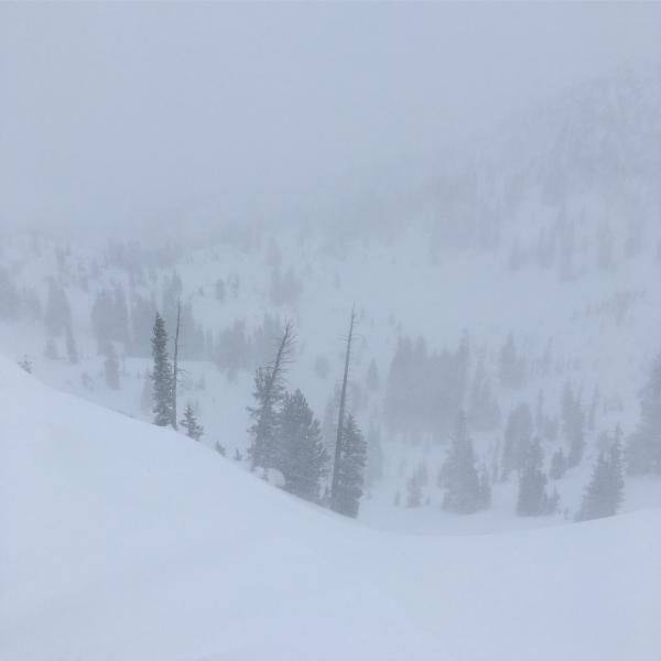
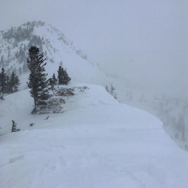
Poor visibility kept me from getting a handle on what slid and what didn't in the Rocky Point, Sunset Peak area, as noted before I did see some soft slab activity in the Steep NE facing Rocky Point area, they were shallow crowns that were filling in fast with the strong winds and snow, they might have been breaking on a layer of graupel that fell yesterday afternoon, but not positive, I wasn't willing to get out on the slope to investigate. Cornices are growing larger and the dense nature of them tends to make them break back further than usual.

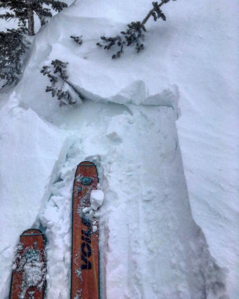
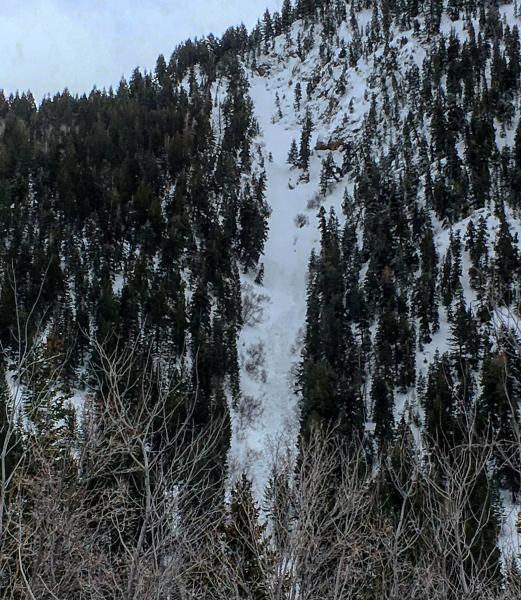
Photos: Cracking in drifted snow on the ridge line, obscured skies up high, wind loading on the ridge line, and a wet slide in Red Chute that I haven't heard about. Tough day to get a photo of anything up high today

With increasing snow amounts and wind I would think we might be nearing the high category tomorrow.

Today's Observed Danger Rating
Considerable
Tomorrows Estimated Danger Rating
High