Visited two drainages today: In the morning skied in Days Fork, and in the afternoon went up 0,420' ridgeline.
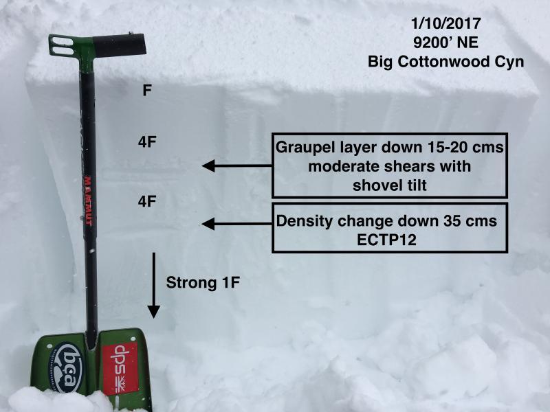
Photo is of pit at 9200' on a NE aspect with two weak layers in the upper 45 cms of the snowpack. I was getting similar results on these layers in both Days as well as 10,420'
Video discussion of results.
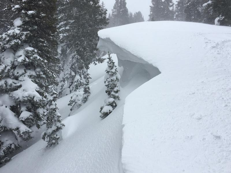
Cornices are growing quite large and are sensitive, breaking back much further than expected.
Video describes how a snowboarder descending down 10,420' ridgeline released a cornice from 20' away from the edge of the cornice. The large cornice drop triggered a class 1 slide down into trees.
Also spent time looking at lower elevations where there is a more layered snowpack. In one pit at 8000' in Days Fork I was finding damp snow down at least 60 cms, and was unable to find any weaknesses within the upper 60 cms of the snowpack. So this pit told me that these low/mid elevations have adjusted to the recent rain on snow event.
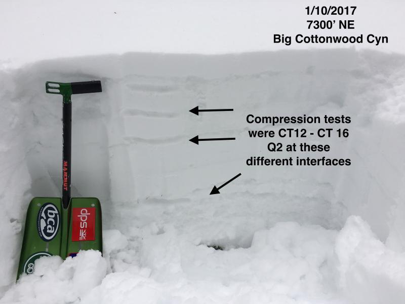
However, at the end of the day I decided to look at the snowpack in Butler Fork, and wandered up the drainage and dug a pit on a NE aspect at 7300' and found several distinct layers where I was getting Q2 quality shears at different layers. The snowpack was damp to the ground (~75 cms). I think the increasing cold temperatures will continue to lock up the snowpack at the lower elevations, but any rapid loading may create avalanche problems at lower elevations.
Overall today was finding a Moderate hazard in wind-sheltered terrain, and Considerable in wind-loaded terrain. Given expected storm snow as well as strong winds on our stressed snowpack, and expecting a High avalanche hazard for Wednesday.
The good news is that overall we have a deep and strong snowpack. We are at about 150% of the median for this time of year, and no lingering persistent weak layers. We have just had a long period with lots of snow, rain, and wind, and there is more snow and wind overnight and into Wednesday. Once this next storm clears out, it looks like we'll get a break from stormy weather which will allow our snowpack to stabilize and adjust to the load. I believe we will emerge with a strong and deep snowpack, but at the moment we just have to be patient.


