Observation Date
1/7/2017
Observer Name
Paradis
Region
Salt Lake » Park City Ridgeline
Location Name or Route
Park City Ridgeline
Weather
Sky
Overcast
Wind Direction
Southwest
Wind Speed
Light
Weather Comments
Cold air pooled in valley bottoms overnight. Single digits at Park City base area but in the teens at higher elevations. Really a very comfortable day with generally light winds. Winds and high clouds increased as the day went on.
Snow Characteristics
New Snow Depth
6"
New Snow Density
Medium
Snow Surface Conditions
Powder
Snow Characteristics Comments
Snow had settled since earlier in the week and was dense and surfy. All aspects had pretty good snow with very limited sun or wind crust.
Surface snow was faceting slightly. Surface hoar was growing in protected areas.
Red Flags
Red Flags
Heavy Snowfall
Wind Loading
Poor Snowpack Structure
Red Flags Comments
Many of red flag conditions are present in the snowpack but not very touchy or reactive. It's also far better than most years. For example, there has been a lot of recent snow but on many aspects it seems relatively well bonded. I found some burried near surface facets in north and west facing pit but got limited results in my pits. I stomped on some wind drifts but didn't get cracking.
Avalanche Problem #1
Problem
Persistent Weak Layer
Trend
Increasing Danger
Problem #1 Comments
Although generally not very reactive in snowpit tests and many slopes have been skied, burred NSF are present in places and could be a factor with 2" of water forecast.
Avalanche Problem #2
Problem
New Snow
Problem #2 Comments
With lots of new snow in the forecast, instability within and between the new and old snow may be an issue. Winds + wet snow may rapidly create new storm slabs.
Snow Profile
Aspect
Northwest
Elevation
9,400'
Slope Angle
25°
Comments
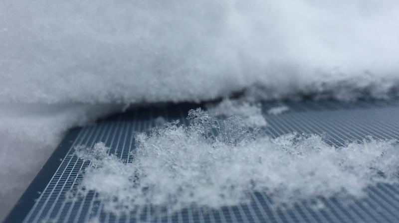
Also dug a pit in on a west facing slope in Bear Trap. Overall nicely increasing density profile with no results from ECT. I did find some rounding NSF approximately 50cms down. Three mm surface hoar laying down on snow surface (photo below). I suspect this will be destroyed by the upcoming wet and windy storm.
Today's Observed Danger Rating
Moderate
Tomorrows Estimated Danger Rating
High