Observation Date
1/6/2017
Observer Name
Wilson, Hardesty
Region
Salt Lake » Big Cottonwood Canyon » Butler Fork » Butler Basin
Location Name or Route
Butler Basin
Weather
Sky
Clear
Wind Speed
Calm
Weather Comments
Cold air, particularly where it pools in shaded basins, protecting most snow. Still, steep solar aspects got their share of incoming shortwave. Winds calm, no significant transport of the light snow visible on our tour.
Snow Characteristics
New Snow Depth
6"
New Snow Density
Low
Snow Surface Conditions
Powder
Snow Characteristics Comments
Marvelous skiing on feathery crystals, particularly at lower angles and in more protected terrain. Best skiing yet, really. Wind from mid storm made for crusts several inches below the powder up near ridglines and along midslope shoulders; its patterning was even visible in some valley bottoms. By later afternoon on steeper SE through S aspects a thin zipper crust was evident 1.5 cm below the unaffected particles on the surface. Energy from direct sun was easily dissipated at the surface, but under the thin blanket led to dampening snow. Lots of loose sluffs to be seen, particularly but not exclusively under rock bands. A couple crowns visible in upper Alexander, not sure whether they failed within the new snow, at the suspect interface from late December facets and surface hoar, or elsewhere. Still, the snowpack seemed basically stable.
Snow Profile
Aspect
Southeast
Elevation
9,200'
Slope Angle
28°
Comments

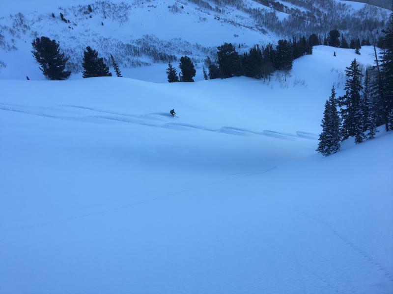
Butler, climbing toward Mill Creek.BCC ridge. 9200', 140° (SE), 28° slope, HS 130. Plenty of crusts to go around; surprised to get propagation under a 3cm crust (presumably melt since no counterpart on NE aspects nearby?) on ECT, but this result wasn't repeated. A pit at 9500 N aspect in Butler basin had no propagation on ECT, although CTM/H and ECTN around 50 cm down on a thin layer of small facets.

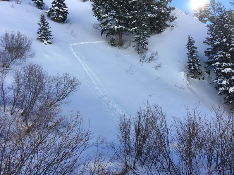
Poor sluff management by local biota
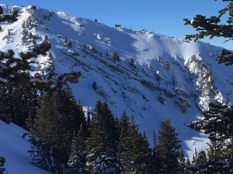
1 to 2' deep crowns in upper Alexander from Wednesday night/Thursday...most triggered by sluffs cascading down and over cliff bands from above.
Dusk patrol powder turns
Today's Observed Danger Rating
Moderate
Tomorrows Estimated Danger Rating
Moderate