
Long tour today in mid Big Cottonwood Canyon that covered all aspects in terrain from 7400' to 9600'. Overall the snowpack did not look especially sensitive. In the top 30 cms (12") of snow I was able to get clean shears with shovel tilt tests at density inversions, although these will heal quickly. Was also surprised to find the very low-density storm snow from Monday and Tuesday had compressed significantly into a 4-F slab. Dug numerous pits on all aspects and found no clear pattern - the upper 45-60 cms (18-24") of the snowpack varies quite a bit, likely due to varying snow totals from Monday/Tuesday, as well as warmer temps and strong winds on Wednesday.
In many pits, I could only get poor-quality shears in density inversions in the recent storm snow, and I only could get one extended column to propagate. In all pits I dug the snowpack was showing signs of settling and adjusting to the recent storm snow and wind. However, given the presence of buried weaker layers, in my view it is best to give steeper slopes at least another day to settled out.
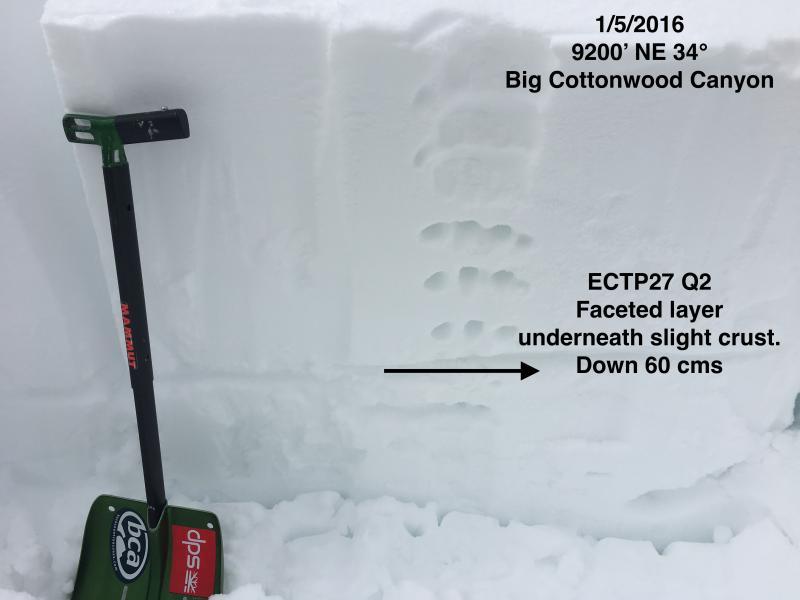
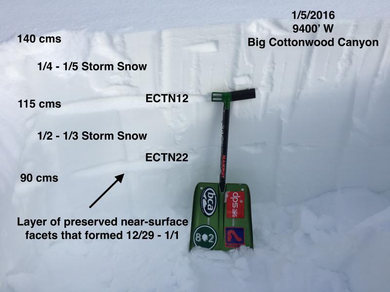
Although I dug several pits today, these two were the most interesting. The first shows the structure of the only pit I dug that got an ECT to propagate. The second clearly shows the storm snow layers from this past week sitting on top of the preserved layer of near-surface facets.
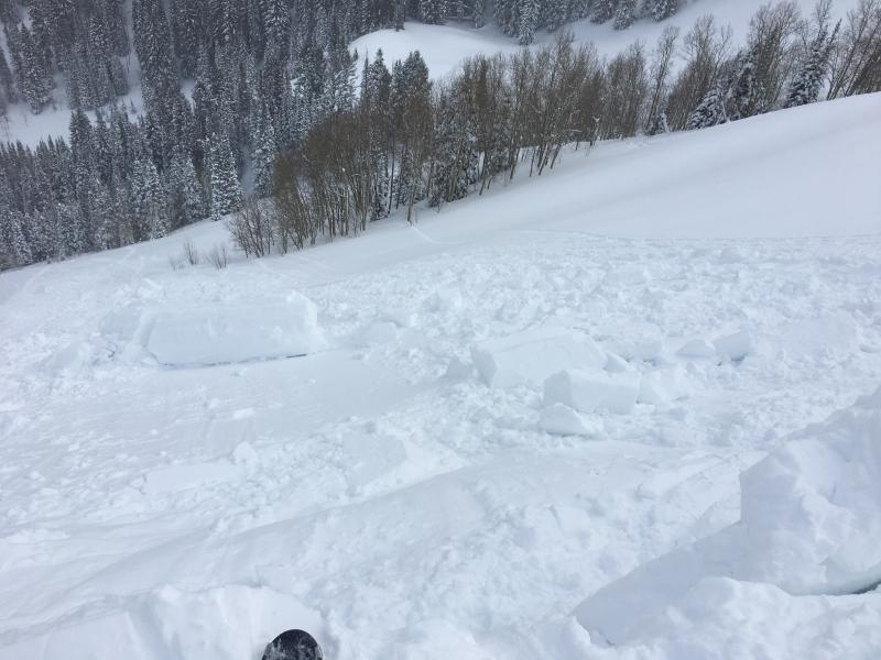
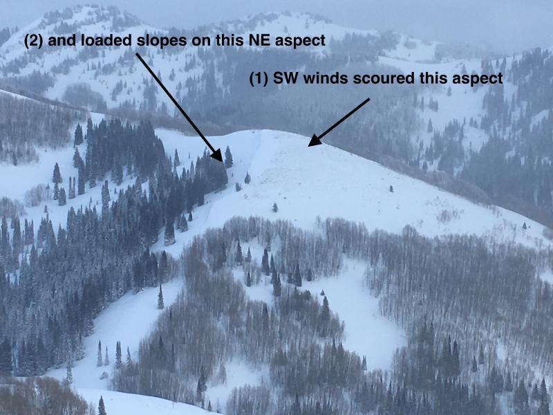
The following photos show evidence of the wind. I noticed several large cornices, and a party ahead of me dropped a very large cornice onto the East face of Reynolds that only produced sluffing. (My photo, but not my cornice drop.) The last photo shows evidence of scouring on windward aspects, and wind-deposited snow on leeward aspects.
Bottom line: Although I saw lots of evidence of stability today, the amount of new snow and wind from this past week, and weaknesses in the snowpack structure in the upper 60-75 cms (2 - 2.5') tell me to give the snowpack at least another day to settle out. Fortunately, there is plenty of excellent riding on all aspects.


