Observation: Cardiff Pass

Observation Date
1/3/2017
Observer Name
Tyler Falk
Region
Salt Lake » Little Cottonwood Canyon » Cardiff Pass
Location Name or Route
Cardiff Pass & Fork
Weather
Sky
Overcast
Wind Direction
Southwest
Wind Speed
Moderate
Weather Comments
Lower canyon had inverted temps with the valley being colder than the powerplant/GWI. Back to freezing by Little Pine and then 27 degrees at the base of Alta. Temps at 10k were siginificantly colder which were in the teens. Winds on 10k ridgelines blowing and transporting snow to the North aspects. No precip durring the day today. Storm total for upper LCC 23" with 1.19" of H20 which gave us a density of 5.2%.
Snow Characteristics
New Snow Depth
23"
New Snow Density
Low
Snow Surface Conditions
Powder
Snow Characteristics Comments

Around two feet of low density snow above 9k. Height of snow around 230cm on north aspects at 10k in upper LCC. Percent of median for snowfall at the snowbird snotel site up to 148% as of last night. No human or natural avalanches noticed today. Cornices did not show any results when released and snow seamed to be fairly well behaved. I suspect that with another two or three inches of water weight that will change in the next few days. ECT'S showed no propagation on north aspects at 10k with poor quality fractures at 7,15 & 65cm down. Wind slabs were found and developing around 10k where the low density snow blew around easy.

Red Flags
Red Flags
Heavy Snowfall
Wind Loading
Red Flags Comments
Lots of light snow around for transport. Did not see any new avalanches today. Sluffs were running shorter than expected.
Avalanche Problem #1
Problem
Wind Drifted Snow
Trend
Increasing Danger
Problem #1 Comments

Wind slabs should be expected on a variety of aspects tomorrow likely on the north half of the compass. Once the winds ramp up into the 40's as expected tomorrow we should see some natural windslabs at the very least occuring.

Avalanche Problem #2
Problem
New Snow
Trend
Increasing Danger
Problem #2 Comments

With more snow coming tomorrow I would expect storm slabs to be a concern once we get a bit more water weight. Graupel 65cm down on North aspects up high was noticed and might be something to keep a eye on in the next few days.

Comments

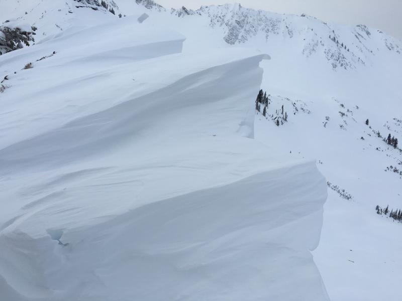
Pic 1 Cornices on North aspects

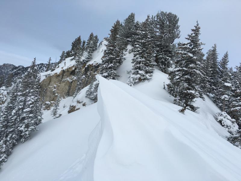
Pic 2 Cornices growing fast

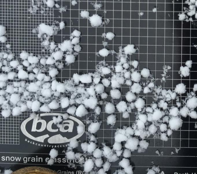
Pic 3 Graupel 65cm down on a North aspect at 10k (3mm gird)

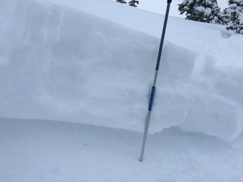
Pic. 4 Quick hand pit showing new storm snow.

Video of Graupel down 65cm in the pack.

Today's Observed Danger Rating
Moderate
Tomorrows Estimated Danger Rating
Considerable