I traveled from 7K to about 9500 feet on the north half of the compass. I traveled in mid elevation sheltered terrain looking for good skiing so I didn't get onto the high ridges that saw the brunt of the wind that accompanied this last storm.
Still quite brushy at lower elevations.
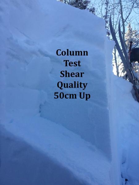
My snowpit tests identified several weak interfaces within the snowpack. Column tests failed with medium effort on all four weak layers with the old snow/new snow interface failing first and each layer under that failing with gradually more effort. Shear qualities were Q2 and Q3 except the interface at 50cm up, which was Q1 but not releasing with much energy. I got no propagation on my extended column tests.
Had I been in steeper terrain that saw more wind and snow the snowpack structure would have raised a red flag.
I would say the danger was moderate where I traveled, slowly trending to a more stable snowpack.


