
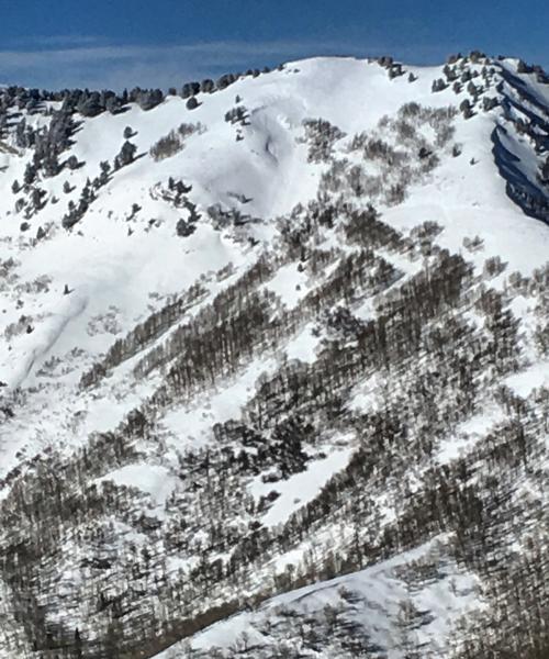
Todays route started at Mill D North Fork, headed up the east ridge of Reynolds Peak, skied the S-SE face of Reynolds, then did a SW facing run dropping into the same drainage, then back over the ridge with a exit out the way we came. The E-NE face of Reynolds had been skied wall to wall by the time we got there with no activity or wind affect noted. The S facing off Reynolds consisted of 14 inches of light density snow sitting on a breakable zipper crust with soft settled snow under that. Did not note much sluffing even on the steeper section of Reynolds S-SE face. The SE was starting to get damp around 1:30pm or so. At that elevation there was not much wind damage or a slab noted, probably a different story with a 1000 more feet in altitude. Only avalanche activity noted was on the SE facing shot that comes off of Wilson Peak, looked like a wind loaded pocket that pulled out sometime yesterday. No real red flags noted today, no cracking or collapsing or unusual wind slabs noted.
Photo: The pocket that pulled out of of Wilson Peak, lookers left side of photo, sorry bad phone photo
Not sure what the weather is going to do but with more daytime heating wet activity may occur tomorrow, and still a bit suspect of high elevation wind loaded terrain.


