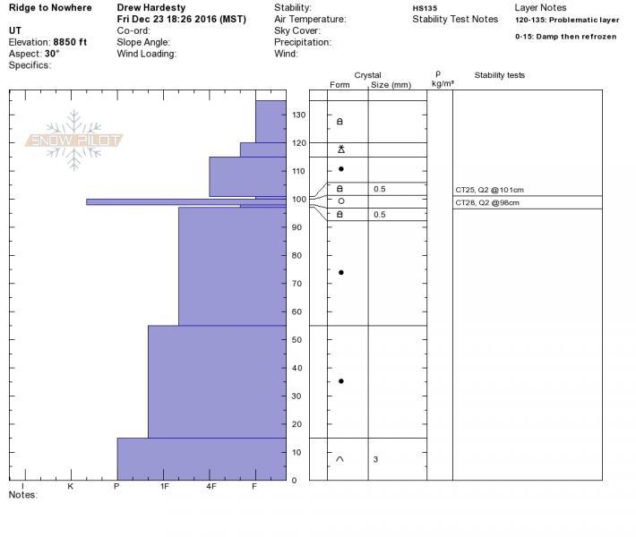
3 snowpit from NW to N to NE showed substantial variety. The lowest, at 8850’ on a NE aspect, showed the crust below the Wednesday’s snow that was absent in pits at both 9150 and 9500. Compression tests gave Q2 results at 25 and 28 above and below this crust.
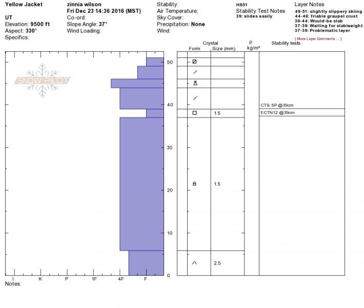
At the higher elevation pits (Toots 60° at 9150’, Yellow jacket 330° at 9500’) the surface snow structure was similar between the locations but the depth was greater in Toots than in Yellow Jacket: HS 110 and HS 51 respectively. At both pits, CTs failed on a layer of facets that underlay the recent storm snow. And in both, that weak layer was overlain by a harder slab, a graupel layer, a softer slab and faceting surface snow. In Yellow Jacket, however, the layer was down 12 cm, failed with easy or moderate taps and slid easily. In Toots the layer was down 30-40 cm, failed only with hard taps and was resistant to sliding.
If this storm gives the 1.5 to 2 inches of water predicted, will the new snow sluff on the slightly faceted surface snow? In locations like Yellow Jacket, is the facet layer weak enough that the addition of weight and a slab would cause failure there instead and thus lead to bigger and more connected slides?
The basal layer of both pits was damp and rounding facets that showed no reactivity in our tests, but after the Birthday Chutes avalanche I’d hate to write them off entirely. Between the large basal facets and the weak layer above, Toots had strong deep snow while the shallow Yellow Jacket site had dry sugary facets throughout.
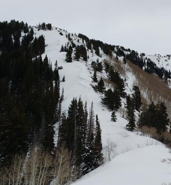
Scouring and wind pillows.