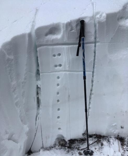
Wanted to get a look at N facing in Millcreek before the storm, to see if the surface was faceting, and also take a look to see if there were any weak layers. Dug a pit on a N facing slope at 9'444ft, wind protected and a slope angle of 40 degrees, entire snow pack is 48 inches deep. No real weak layers, thin damp and compactible layer at the ground interface and a one finger dense and compact pack up to where the last storm cycle sits, then its basically two finger dense snow, with about six or seven inches of lighter density capping it off. No shears or weak layers were noted in a isolated column test. I'd say by far the weakest part of the snow pack is on the surface, we were getting sluffing in steeper terrain and the surface of the snow is defiantly weakening but not to a alarming amount, I think the cloudy nights and warm days have slowed the faceting process down. The wind was picking up from the south but the south facing slopes are crusted so there wasn't much wind transport. All in all a stable snow pack in the terrain covered.
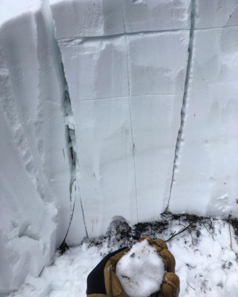
Photos: Pit, the bottom line is not a weak layer just the interface between the old and the new snow, damp snow at the base of the pack, surface hoar growth in the bottom of the drainage. not a master pit digger, a little crooked.