Observation Date
12/17/2016
Observer Name
Hardesty, Wilson
Region
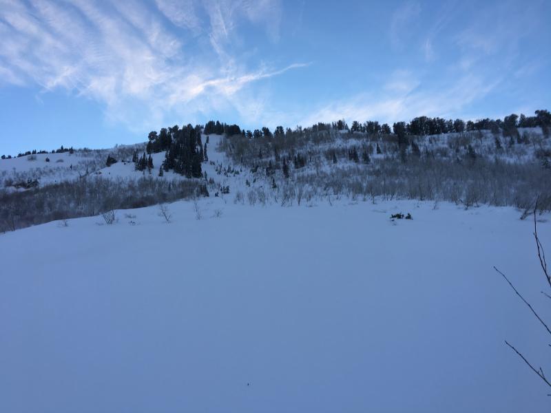
Provo » Provo Canyon » North Fork Provo R. » UFO Bowls
Location Name or Route
UFO Bowls
Weather Snow Characteristics
New Snow Depth
20"
Snow Surface Conditions
Powder
Snow Characteristics Comments
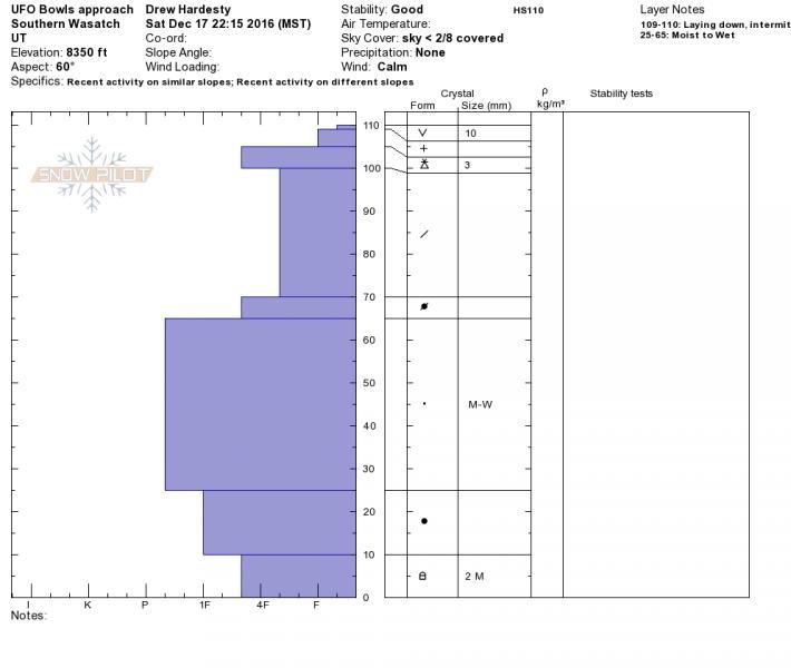
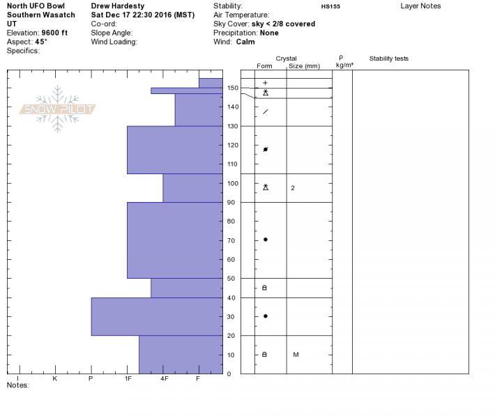
Significant rain up to 8000' or so, saturating many layers in the mid-pack. see profile. Cold new snow now well insulating this layering.
Only a couple inches of low density snow sit above yesterday's frontal passage supportable graupel crust. Smooth, fast creamy skiing.
Red Flags
Red Flags
Recent Avalanches
Red Flags Comments
Widespread size 2 and 3 natural cycle many aspects late on the 15th or early on the 16th.
Today, though, found mostly stable snow with no cracking, collapsing, or much in the way of a poor snowpack structure. Would imagine (conservatively) lingering areas of Moderate in mid and upper elevation wind drifted terrain.
Avalanche Problem #1
Problem
New Snow
Trend
Decreasing Danger
Problem #1 Comments
See profiles - thin graupel "slab" failing on lower density snow in upper 20cm though not corresponding to conditions in terrain we traveled. Size 1 low density snow sluffing running on supportable, stout "graupel" crust in steeper terrain.
Avalanche Problem #2
Problem
Wind Drifted Snow
Trend
Decreasing Danger
Problem #2 Comments
Welded in along our travels along the UFO bowls though perhaps a few drifts above 9600' likely still potentially active with human weight.
Stability much improved after natural cycle. Would imagine areas of Moderate in mid and upper elevation wind drifted terrain with deeper slabs very unlikely even with heavy loads. Low elsewhere. Sluffing likely still a consideration for Sunday.
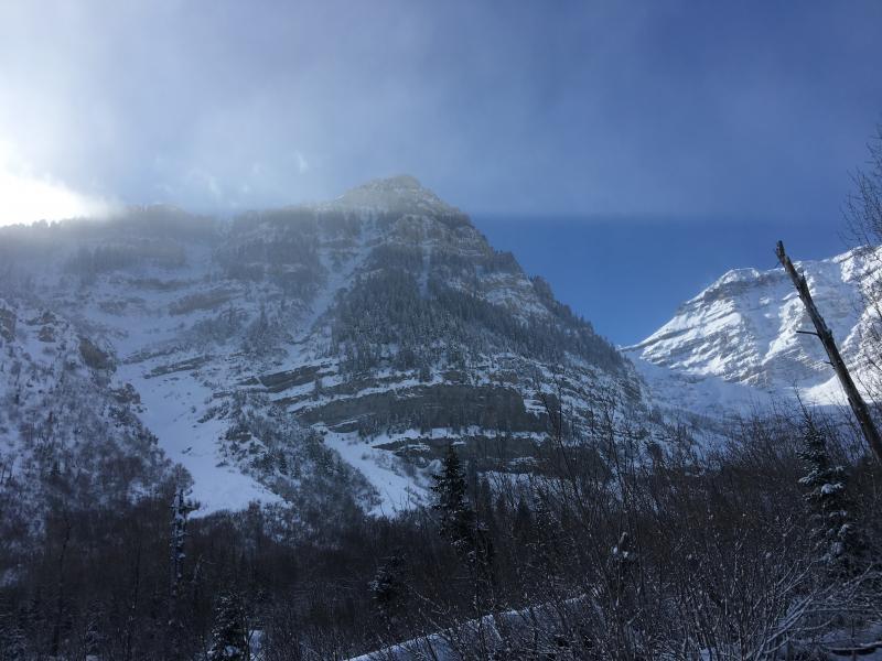
Photos of some longer running naturals in the Provo mountains: to include west facing Cascade ridge, NE chute of Elk Point, and North UFO Bowl.
Today's Observed Danger Rating
Moderate
Tomorrows Estimated Danger Rating
Moderate