To quote Nobel laureate Bob Dylan, "I can't help it if I'm lucky." Got lucky and found a weak layer with touchy conditions this morning.
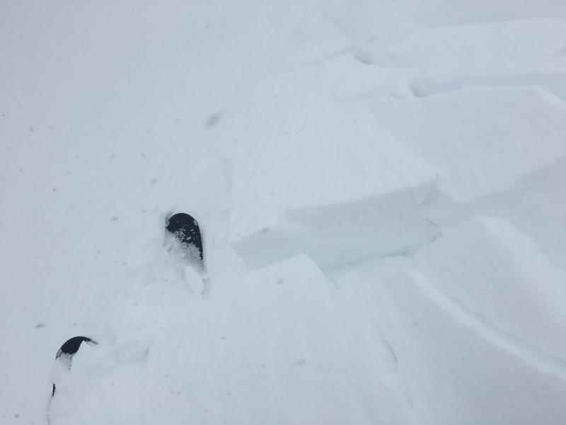
Went out for a quick lap up to Patsy Marley, and was interested in how the new snow was bonding to the old snow surface. Shovel tilt tests were getting clean shears at the old snow interface indicating a poor bond. Had my scope with me, but with new snow falling and some wind, hard to determine the type of weak layer. Likely small-grained near surface facets, or decomposing fragments turning to facets. With very little new snow (5 cms/2") currently not a concern, but with storm totals by Sunday expected between 1-2' with perhaps 2" of water weight, this is another persistent weak layer in our snow pack we will have to watch.
Moving along the ridgeline from Twin Lakes Pass to Patsy Marley was finding very sensitive conditions with fresh soft wind slabs easily cracking just as you tapped on a slope, or dropped a small cornice. These were shallow (5-15 cms/2-6") and soft (at most 4F), but they were failing at the old snow/new snow interface. The widest was about 120'. Most interesting was a tiny 30 cm (1') cornice drop that fractured a shallow wind slab which sympathetically pulled out another slab on an adjacent slope.
Poor quality, but photo and two videos from my short tour describing what I was seeing this morning.