
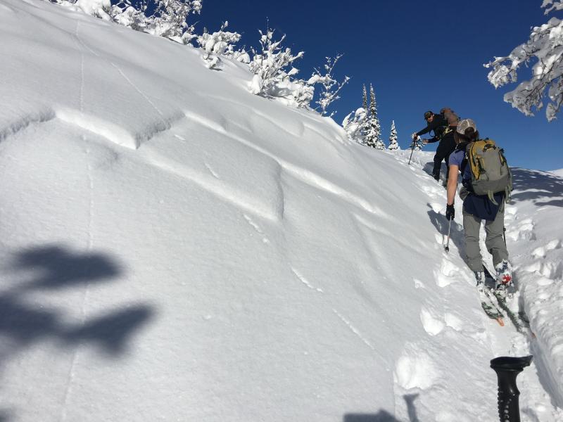
Went up Cutler Ridge today to check on the weak layer we had identified on Friday. It was a really wonderful day the sun showed through and the wind blew. The Who’s Who of Ogden backcountry skiing were out today. We missed you Brian and Doug! On the hike up the summer trail many small natural avalanches were noted on all aspects failing above the rain layer in the low density stellars from yesterday. Indicator hill had also naturalled and had a decent debris pile. We looked in the snow on the ESE aspect of indicator hill and did not find many suspect layers. As we continued up the ridge many large (D2) avalanches were noted in black canyon and D3 Avalanches in the Cutler Basin (Ben Lomond though Willard Head wall). We were unable to inspect these avalanches. A few other places on Cutler Ridge slid that are not usual paths. We stopped and dug on a N aspect at 8300 feet just above dead tree. Here we were able to find the suspect layer from Friday’s (12/9) obs but it is gaining strength. Now I would say it is F+ hardness. This is good. I was able to get layer to fail but it was difficult and not repeatable in near by snow pits (ECTP15 SP, ECTP30 RP). This layer is approx. 60 cm down from the snow surface below a crust (wind or sun) the facets that formed are getting stronger since Friday. You can identify this layer really well with compression tests or shovel shear tests. We than traveled up to the Ben Lomond shoulder to check out the natural activity in Bailey Cabin. These were much easier to view. It seemed that the initial avalanches had failed on the NSF about 60 cm down. We noted two avalanches that did step down to the ground one in Bailey Springs proper and the other in the Bailey Cabin Cirque. These avalanches failed on the persistent layer on the ground. They failed on Sheltered N-NE aspects with a grassy smooth surface underneath. We exited down Cutler Ridge.
There is wonderful supportable skiing in low angle terrain still on Cutler. Most of the Bush is now covered up!!
Natural on the Black Canyon Ridge (D2)
Hard to See Natural Avalanches in Willard Head Wall
Bailey Cabin Finally!!


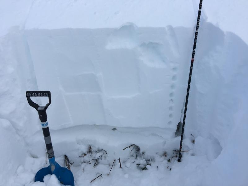
Snowprofile 8200 ft NNW aspect
ECTP 15 SP on F+ hardness under 1F crust
Shallow new snow naturals and cracking on nearly everything that had a steep enough slope. Within storm snow on low density stellars.
Last week's very low density snow faceted - a 5-8 mm layer of .5mm facets nearly 2 feet down now and stubborn if reactive at all in our pit profiles.
Last photo shows the array of naturals: 4" storm slab, 2' deep persistent slab, 3-4' deep slab. This at roughly 8600' NNE.


I think last night we reached High danger but decreased through the day today. Stubborn weak layers in snowpits and on test slopes.


