Observation Date
12/10/2016
Observer Name
Jake Hutchinson
Region
Salt Lake » Little Cottonwood Canyon » Grizzly Gulch » Twin Lakes Pass
Location Name or Route
Twin Lakes Pass
Weather
Sky
Obscured
Precipitation
Heavy Snowfall
Wind Direction
West
Wind Speed
Strong
Weather Comments
Nuking graupel and wind for a number of hours today. Rapid loading occuring on all slopes on the East half of the compass
Snow Characteristics
New Snow Depth
7"
New Snow Density
High
Snow Surface Conditions
Powder
Snow Characteristics Comments

Top 3" were graupel, mix of rimed forms below that. Awesome fast skiing.

Red Flags
Red Flags
Recent Avalanches
Heavy Snowfall
Wind Loading
Cracking
Red Flags Comments
New snow isn't bonded well to old snow surface, although the few small slides I triggered were a little hesitant to get moving after they intially failed.
Avalanche Problem #1
Problem
Wind Drifted Snow
Trend
Increasing Danger
Problem #1 Comments

Sensitive wind slabs 4-12" deep, some breaking up to 25' remotely, found in multiple elevation bands on NE through SE slopes. I suspect these will get more sensitive and reactive as the load increases tonight.

Avalanche Problem #2
Problem
New Snow

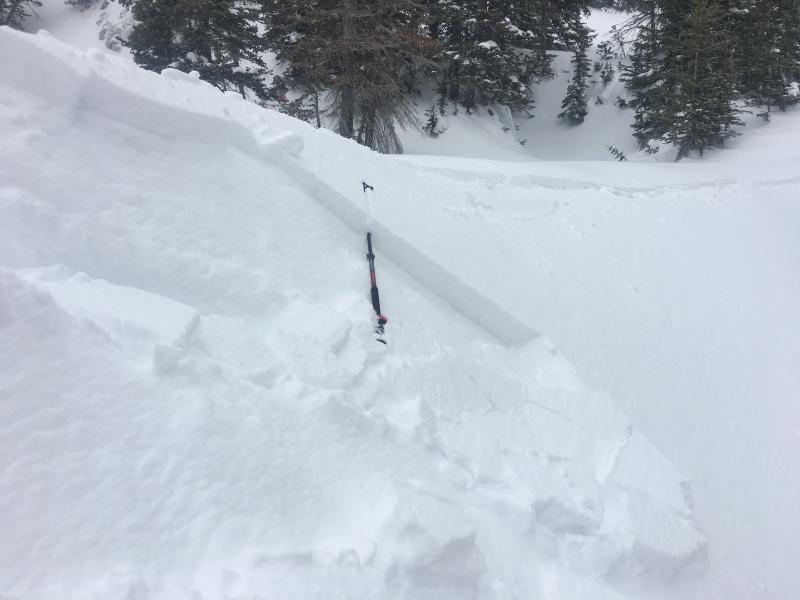
Small avalanche intentionally triggered on a small gully sidewall.

Video
Today's Observed Danger Rating
Considerable
Tomorrows Estimated Danger Rating
Considerable