Observation: Lake Mary

Observation Date
12/9/2016
Observer Name
BT
Region
Salt Lake » Big Cottonwood Canyon » Brighton Perimeter » Lake Mary
Location Name or Route
Brighton Perimeter
Weather
Sky
Overcast
Precipitation
Light Snowfall
Wind Direction
West
Wind Speed
Moderate
Weather Comments
Traveled from 2:30 to 5:30pm. Started sunny and clear and gradually became more overcast and windy.
Snow Characteristics
New Snow Depth
6"
New Snow Density
Medium
Snow Surface Conditions
Powder
Snow Characteristics Comments

Snow surface was moderate density snow. Rimed crystals with graupel. Produced sluffs easily.

Red Flags
Red Flags
Wind Loading
Cracking
Avalanche Problem #1
Problem
New Snow
Trend
Increasing Danger
Avalanche Problem #2
Problem
Wind Drifted Snow
Trend
Increasing Danger
Snow Profile
Aspect
Northeast
Elevation
9,600'
Slope Angle
28°
Comments

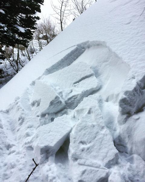
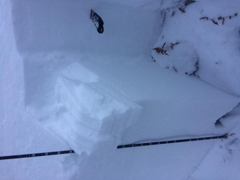
Average snow depth in the area was 85cm. I was not able to get any propagation on the old snow surface in 3 different ECTs although the snow was easy to fracture on steep test slopes in the area.

ECTN

​CT 8 RP (Q2) @ 18cm

​CT 13 RP (Q2) @ 38cm

Today's Observed Danger Rating
Moderate
Tomorrows Estimated Danger Rating
Considerable
Coordinates