I especially wanted to look at any buried sun crusts on the south through westerly facing slopes. A lot of variability - thin to nonexistent on some slopes, well bonded on some, and a red flag on other slopes. Concern is where the crust is poorly bonded to the snow below - video below. It will give the potential for slightly deeper and wider slides. Between the widespread low density snow that's on the surface on just about all aspects and these scattered thin crusts, I expect the steep southerly through westerly facing slopes to be more active this storm cycle - more avalanches.
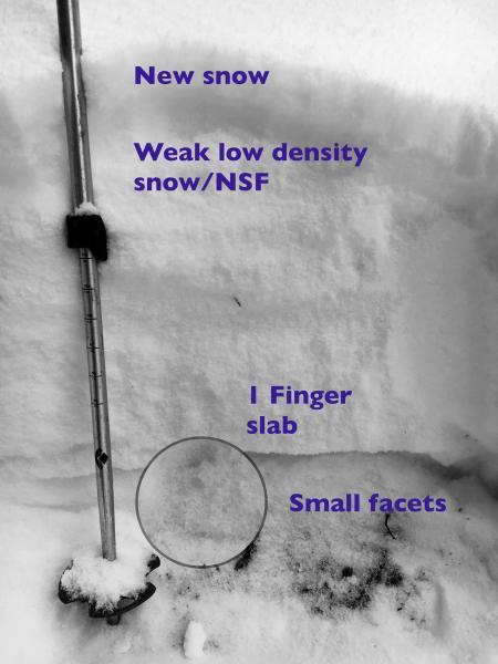
Also took a quick look at the snow pack on a northerly facing slope, 7600'. Any areas with a shallow snow pack have faceted to some degree during the cold temperatures, including some low and mid elevations. In the lower elevation snow pit below, the weakest snow is just below the inch or two of new snow. The weak snow is the 5% density snow that's added up over the past few days, some of which seemed loose and a bit faceted (near surface facets).
The storm looks awesome - lots of dense snow to build a base and increase the depth of our snow pack. While the avalanche danger will certainly spike over the next few days, we'll end up with a more stable snow pack in the long run.


