Sign Up for the Utah Snow and Avalanche Workshop (USAW) on December 7th!

Observation: Cedar Spring Canyon

Observation Date
12/2/2016
Observer Name
Toddeo
Region
Southwest » Pahvant Range » Chalk Creek » Cedar Spring Canyon
Location Name or Route
Pahvants - Cedar Spring Canyon
Weather
Sky
Broken
Precipitation
Light Snowfall
Wind Direction
West
Wind Speed
Light
Weather Comments
Sky was mostly obscured with some sunny breaks. Light snow throughout the day.
Snow Characteristics
New Snow Depth
2"
New Snow Density
Low
Snow Surface Conditions
Powder
Snow Characteristics Comments

2" with most of it falling today, Very low density more would have been nice, All aspects stayed dry. Trail breaking not bad 6" of ski penetration, However, the only reason I was able to get to this spot was because I broke a bunch of trail during the week.

South aspects skied better with a more consolidated "base" and less brush, see profile below.

Red Flags
Red Flags Comments
None in this area. I would have been more cautious if I was on upper elevation north facing aspects.
Avalanche Problem #1
Problem
Normal Caution
Trend
Same
Problem #1 Comments

Normal caution for skiing in low snowpack areas.

Snow Profile
Aspect
Northwest
Elevation
8,400'
Slope Angle
25°
Comments

Thin but solid profile. HS-(25-26)", The basal 5" or so consists of a degrading 1 finger recrystalized granular (2mm or so) melt forms. No facets. The upper 20 or so inches grades from 2 finger at the base to 4 finger near the top. Capped with 1-2" of fluff.

I did see some facets on more northerly and sheltered aspects but nothing alarming.

I made it to about 9200' in this area upper areas were a bit more scoured and thinner. I choose a protected area for the profile.

Photo below, typical aspen terrain with a 3-hour approach after driving in 4WD to 6,400'.
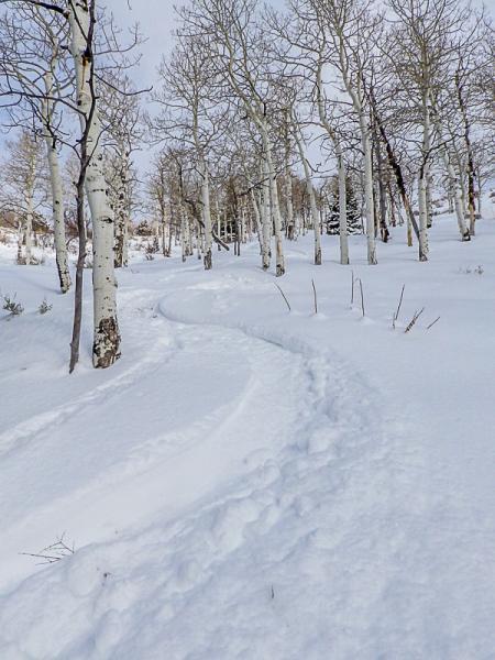
Hazard is low in this area but I wold say an overall hazard of moderate.

Today's Observed Danger Rating
Moderate
Tomorrows Estimated Danger Rating
Moderate
Coordinates