Observation Date
11/29/2016
Observer Name
Tyler Falk
Region
Salt Lake » Little Cottonwood Canyon
Location Name or Route
LCC Ridgeline South
Weather
Sky
Obscured
Precipitation
Light Snowfall
Wind Direction
Northwest
Wind Speed
Light
Weather Comments
Obssured sky most of the day in Little Cottonwood above 10k as the storm moved out. Light snow off and on the seccond half of the day. Generaly light winds on 10k ridgelines. Not much transport of the new snow occuring that we saw. 17 Degrees when I left Alta at 430.
Snow Characteristics
New Snow Depth
12"
New Snow Density
Low
Snow Surface Conditions
Powder
Snow Characteristics Comments

Around a foot of new snow in the last 24 hours from the last wave of the storm above 9k in upper LCC. Cold temps and low density snow on the top of the pack in most sheltered locations. Minor green housing noticed around mid day on certain elevations on south aspects. A few density changes with in the storm snow although they were not very reactive.

Red Flags
Red Flags
Heavy Snowfall
Red Flags Comments
Lots of weight from the 2.74" of water in upper LCC with 40" of storm snow like Drew was saying in the forecast this morning. No real transport occuring that we saw.
Avalanche Problem #1
Problem
New Snow
Comments

Surprised to only see a few possible slides today. Looked like some activity around the chokes in Two Trees likely during high PI rates yesterday. The only other slide I saw was while driving down canyon. It was just above the Y in north facing terrain at a relatively low elevation. It looked like a shallow soft slab on possibly a density change within the storm snow. No cracking or whomping noticed on our travels thru mostly south aspects today. Height of snow at 10k on a North aspect was around 115 cm.

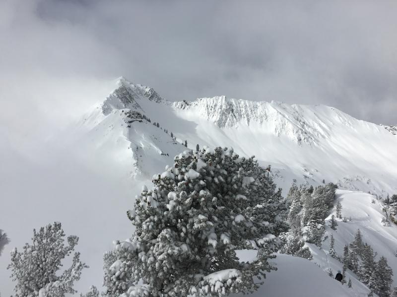
Pic 1. Sky cover going in and out with some crossloading on Black Knob

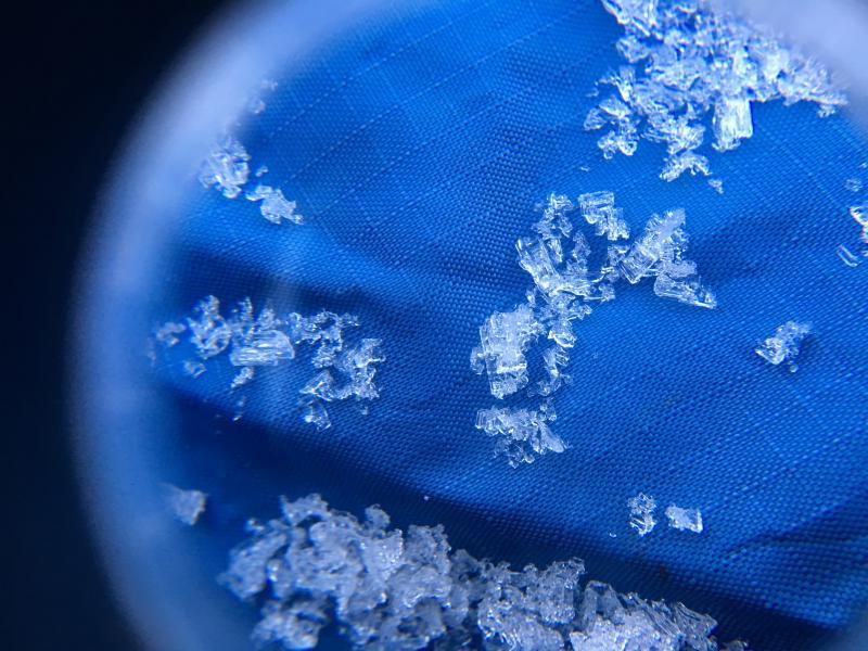
Pic 2. 2mm facets on a north aspect at 10k

Today's Observed Danger Rating
Moderate
Tomorrows Estimated Danger Rating
Moderate