Went for a quick look at the snow near Guardsman Pass. See attached snow profile. This was more of an east facing location but it represented a north facing slope due to a nearby stand of trees that shade it from E and S sun exposure.
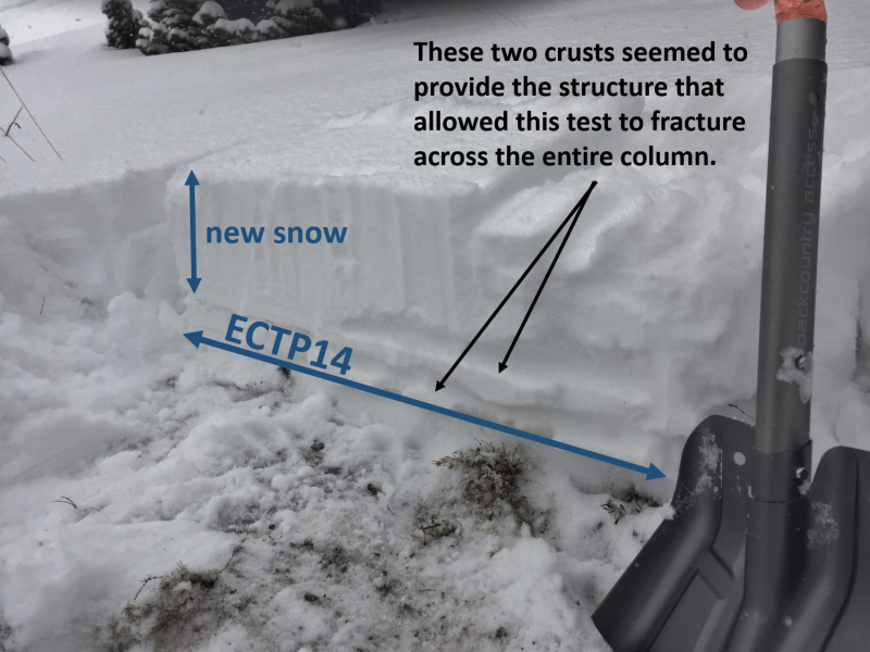
There was a very thin layer of depth hoar crystals at the ground but I don't think this will be a problem in this location. Very small faceted crystals at about 10 cm (4 inches) above the ground were the weakest layer. ECT's did not propagate at this spot but would propagate in any location that had a slightly harder layer in the snowpack. In the photo below there were two crusts that seemed to allow the ECT to propagate. Other locations had other types of hard layers.
It seems like elevations below 9800 feet may be able to handle the weight of new snow especially on S aspects. Higher elevations with some old wind slabs, old facets, and the load of new snow from today and tomorrow should produce some decent persistent slab avalanches.