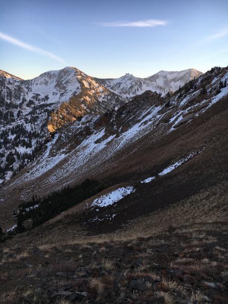
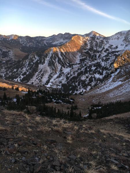
There is so little snow out there, only on the northerly facing slopes, that it's easy to ignore. But we've been surprised before by very shallow snow still acting as a weak layer when we get the next storm.
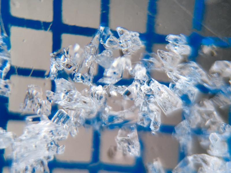
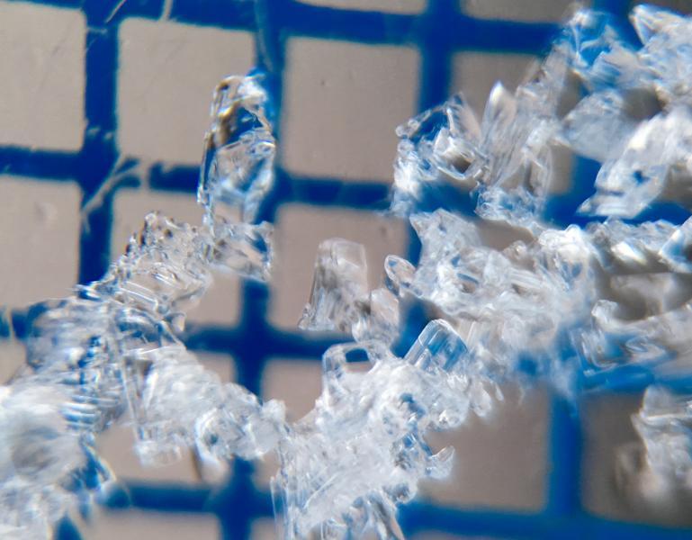
I just had a very quick look in one spot yesterday, the north side of Cardiff Pass, which is only about 10,000'. I was hoping to find only melt/freeze snow. In many places - lower elevations, flatter terrain, any slopes with a bit of east or west that get sun - that is what I found. But due north at 10,000' had a thin crust covering these striated, but very small, facets. Grid is 2mm. So it's worth looking at the snow over the next week, especially 10,500' and above. We have a lot of clear nights in the forecast, and the ground temperature can be much cooler than the air temperature. Even if weather stations have temperatures in the mid 30s, it can be below freezing at the snow surface, with steep temperature gradients almost 24 hours/day. (It would be a great time to deploy some of Brett's ibuttons to check out the real numbers...)
A quick glance at northerly facing slopes - on those at the lower elevations or with east or west aspect, the snow will be mostly melt freeze.
The steeper, northerly facing slopes are the ones of interest.