Planned Website Outage: The UAC website will be down for maintenance on June 17 from 2:00 - 7:00 PM MT.

Observation: Red Baldy

Observation Date
4/27/2016
Observer Name
Tyler Falk
Region
Salt Lake » Little Cottonwood Canyon » White Pine » Red Baldy
Location Name or Route
White Pine to Red Baldy
Weather
Sky
Scattered
Precipitation
Light Snowfall
Wind Speed
Calm
Weather Comments
Scattered clouds early gave way to clear skys around 9:30 am in upper White Pine. Some thunder and clouds moved back in around 11 am which led to some greenhousing. When we left the White Pine trailhead at 1:30 it was 45 degrees and most everything but high north was done.
Snow Characteristics
New Snow Depth
7"
New Snow Density
Medium
Snow Surface Conditions
Dense Loose
Damp
Snow Characteristics Comments

A few inches of heavy snow at the trailhead, (7600’) transitioned to moderate density snow around 8400' on North aspects this morning. From there up it was harder to make a snowball with your hand on north aspects. ECT’s and CT’s showed failures 20cm and 45cm down from the top of the pack. Twenty cm down on a density change and also 45cm down from the start of the storm cycle.

Red Flags
Red Flags
Recent Avalanches
Cracking
Rapid Warming
Red Flags Comments
Warming of the new snow was our main concern today. Minor cracking on steep switchbacks, no collapsing noticed. With the moderate density snow and calm winds I did not notice any wind transport of the new snow even on the 11k ridgelines durring my tour. There was a limited amount of wind damage on high west aspects.
Avalanche Problem #1
Problem
Wet Snow
Trend
Same
Problem #1 Comments

With a few days of snow and the chance for the sun to be out today I felt that Wet Slabs would be the main concern today. There seamed to be a smooth surface under the storm snow 45cm down for them to run. Looked like a mix of graupel under there still waiting to heal. Likely in many locations that received a fair bit of snow and saw some sun.

Avalanche Problem #2
Problem
New Snow
Trend
Decreasing Danger
Problem #2 Comments

A few of the slides I saw seamed to be storm slabs running fairly slow but entrapping a decent amount of snow, R1 or 2, fairly small compared to the path. Still large enough to ruin your day if in consequential terrain. Looks like it is still snowing in upper lcc and noaa/ cottonwoods forecast is calling for a 80% chance of 4-8" for alta guard through 5 A.M. This could keep the storm slabs active the next 24 hours.

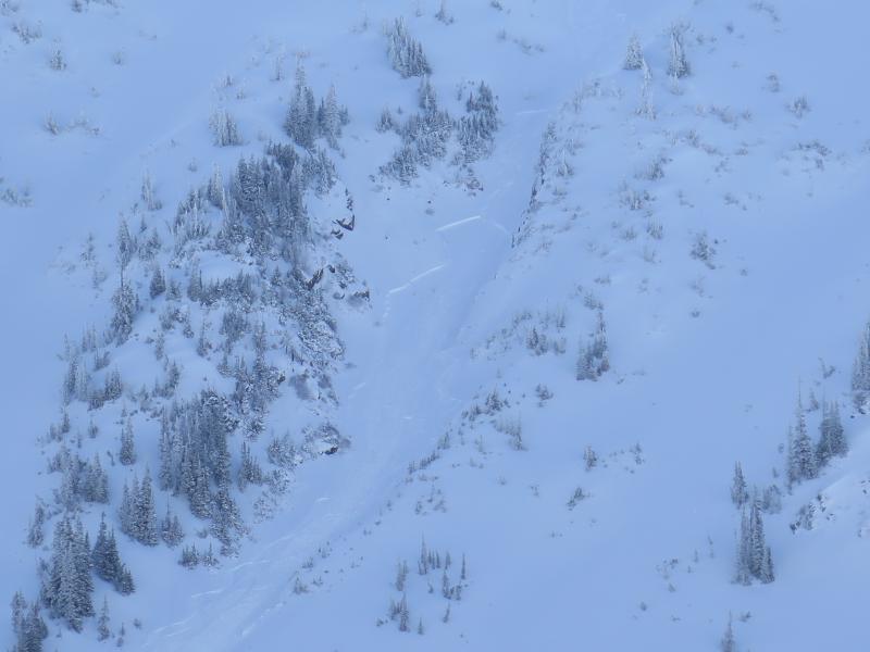
Photo 1. Looked to be a SS-As-R1-D1.5 triggered sometime early this AM on Tri Chutes.

Photo 2. Close up of that slide.

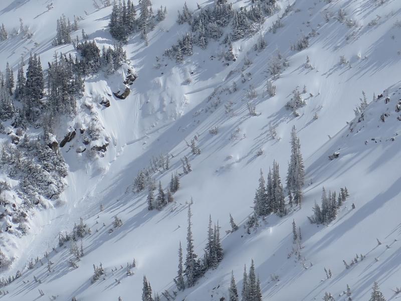
Photo 3. Natural on East aspect.

Photo 4. More activity on East

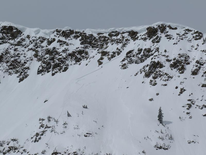
Photo 5. Loose Wet down a little lower on East.

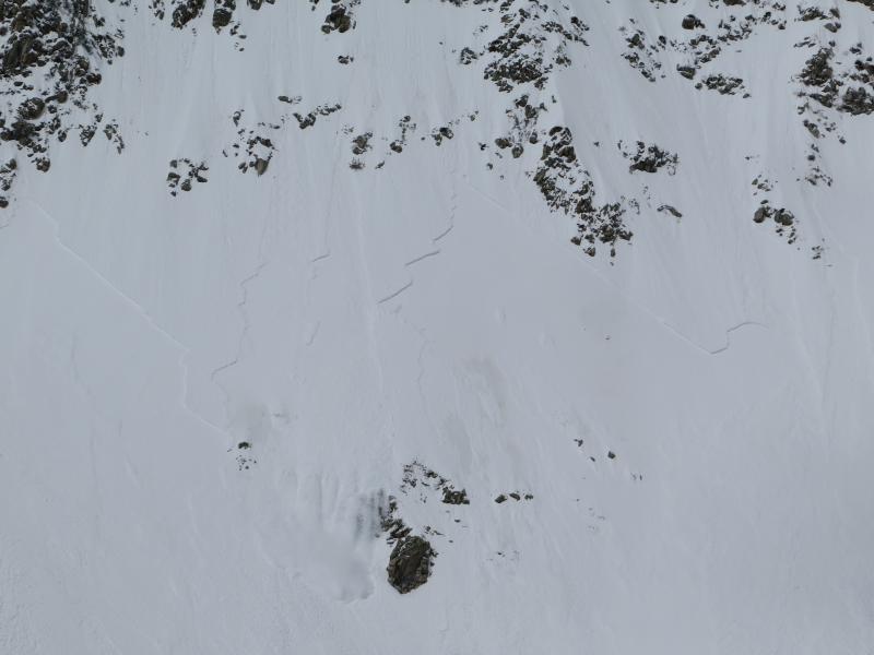
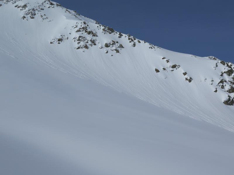
Photo 6. My take on the current conditions.

Today's Observed Danger Rating
Considerable
Tomorrows Estimated Danger Rating
Moderate