Check Out Our Holiday Auction!

Observation: Humpy Creek

Observation Date
4/16/2016
Observer Name
Ted Scroggin
Region
Uintas » Bear River Ranger District » Humpy Creek
Location Name or Route
North Slope-Humpy Creek
Weather
Sky
Broken
Wind Direction
Northeast
Wind Speed
Moderate
Weather Comments
A nice cold start to the day with trailhead temperatures in the low twenties, partly cloudy skies and light north winds. The afternoon brought mostly cloudy skies, moderate northeast winds along the ridge tops and brief peeks of sun.
Snow Characteristics
New Snow Depth
6"
New Snow Density
Medium
Snow Surface Conditions
Powder
Wind Crust
Melt-Freeze Crust
Damp
Snow Characteristics Comments
Looks like the storm put down about 6" of medium density snow in the Whitney area with mostly supportable snow this morning.
Red Flags
Red Flags
Wind Loading
Red Flags Comments
A period of moderate to strong north and northeast winds the last two days developed some fairly sensitive, but shallow wind slabs on the south through southwest facing slopes. This is a bit unusual to see the wind drifting on these aspects.
Avalanche Problem #1
Problem
Wind Drifted Snow
Trend
Same
Problem #1 Comments
Some shallow, but sensitive wind slabs today on unusual south through southwest aspects. These were only 10-12" deep, maybe 30-50' wide and not entraining a lot of snow as they moved down hill. These became less of an issue as the wind mellowed some and the warm weather helped to settle things out.
Avalanche Problem #2
Problem
Wet Snow
Trend
Same
Problem #2 Comments
Very little in the way of wet loose activity, the winds from the north kept things from getting too warm and reactive.
Comments
A nice cold morning made for good supportable riding with about 6" new snow the last couple days. This new snow is capping-off a couple layers of melt freeze crusts with damp snow in-between. Once your sled breaks through these crusts and into the damp layers, its just bottomless wet snow and no base.
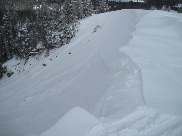
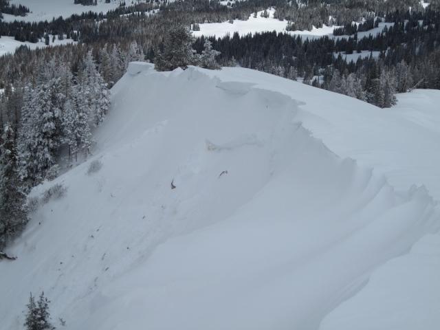
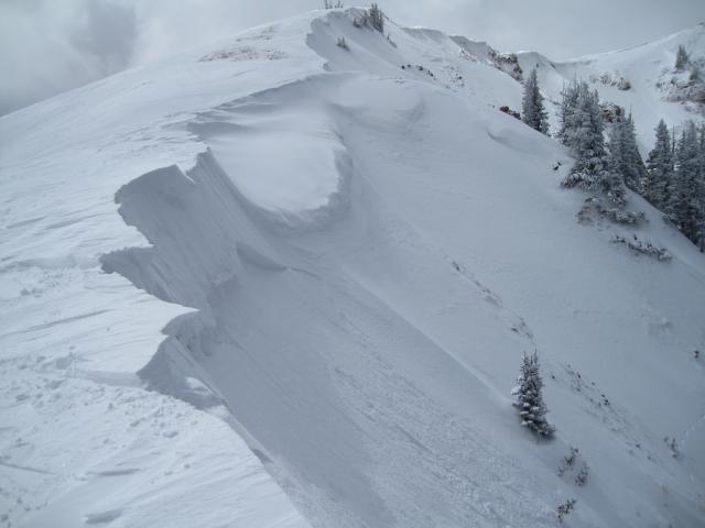
These shallow wind slabs found on south through southwest slopes this morning were sensitive, but with the day time heating these settled out. I would think a few more of these could be possible to trigger tomorrow with more north and northeast winds forecasted.
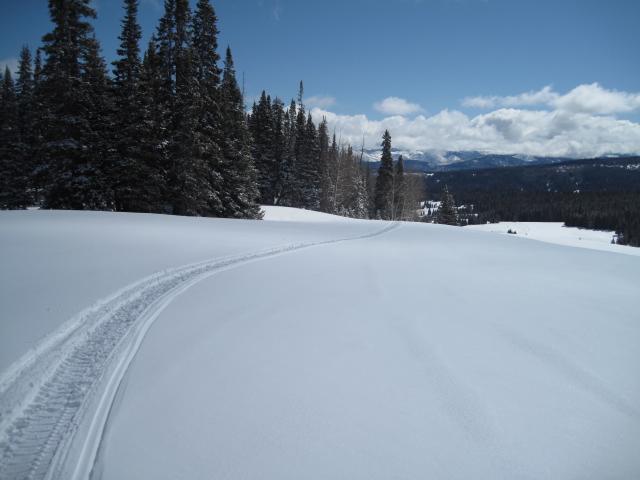
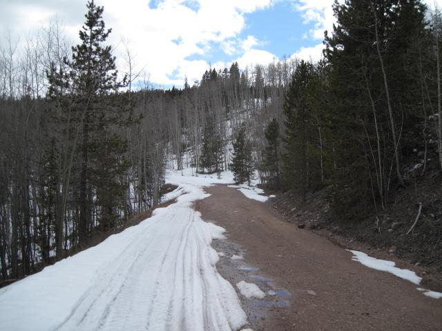
The exits back to the rigs are starting to get a little rough, this stretch of road was white when I went through in the morning.
Today's Observed Danger Rating
Low
Tomorrows Estimated Danger Rating
Low