Planned Website Outage: The UAC website will be down for maintenance on June 17 from 2:00 - 7:00 PM MT.

Observation: Ogden Mountains

Observation Date
4/15/2016
Observer Name
Craig2
Region
Ogden » Ogden Mountains
Location Name or Route
ogden mtns
Weather
Sky
Obscured
Precipitation
Light Snowfall
Wind Direction
Southwest
Wind Speed
Moderate
Weather Comments
When we started the wind was out of the SSW then turned NNW in the early afternoon. Light snow fall in AM then tapered to a stop by 1030. We had on and off white out conditions with the sun making short appearances. The mid elevation winds would fill in our uptrack by the time we returned to it after a lap.
Snow Characteristics
New Snow Depth
10"
New Snow Density
Medium
Snow Surface Conditions
Powder
Melt-Freeze Crust
Damp
Snow Characteristics Comments

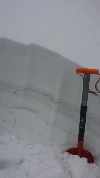
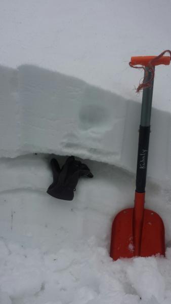
Nice skiing from 9K to about 8400' then would become a bit thicker but still very turnable. We skied between 9000'-7800'. Snow surface was powder but 25cm down there was evidence of the rain from the early part of the storm.

Red Flags
Red Flags
Heavy Snowfall
Wind Loading
Rapid Warming
Poor Snowpack Structure
Red Flags Comments
Did a quick pit with an ECTN12 at 39cm from the top. Below the new snow was a crust with damp week snow below it from the rain Wednesday night. See pictures below. When the sun comes out we may see some action with the new snow on top of the damp snow. Ski cuts produced no results. Going with a moderate rating for today and tomorrow but will rise to considerable tomorrow with rapid heating.
Avalanche Problem #1
Problem
Wet Snow
Trend
Increasing Danger
Avalanche Problem #2
Problem
New Snow
Trend
Same
Problem #2 Comments

Storm slab stepping down to the weak snow below.

Snow Profile
Aspect
Northwest
Elevation
8,800'
Slope Angle
32°
Today's Observed Danger Rating
Moderate
Tomorrows Estimated Danger Rating
Moderate