Mighty quiet day in the hills. Temperatures were warmer Thursday morning, and East aspects starting to soften at about 930. Despite that weather stations were reporting temps > 0 C, the clear night provided a decent radiational refreeze with supportable snow on all aspects in the early morning.
Low hazard today. Plenty of evidence we have been through our wet cycle from last week's storm, and this week has been very cooperative with somewhat warm temperatures during the day, and freezing overnight.
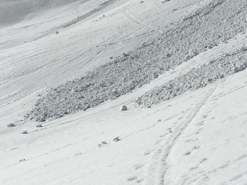
Image shows loose wet activity (likely from this past weekend) covering an old skin track. Unsure of the timing as to when this skin track was put in, but when wet avalanche activity* is a concern, always be sure to put in a skin track away from the runout zone.
(*Could read any avalanche activity.)
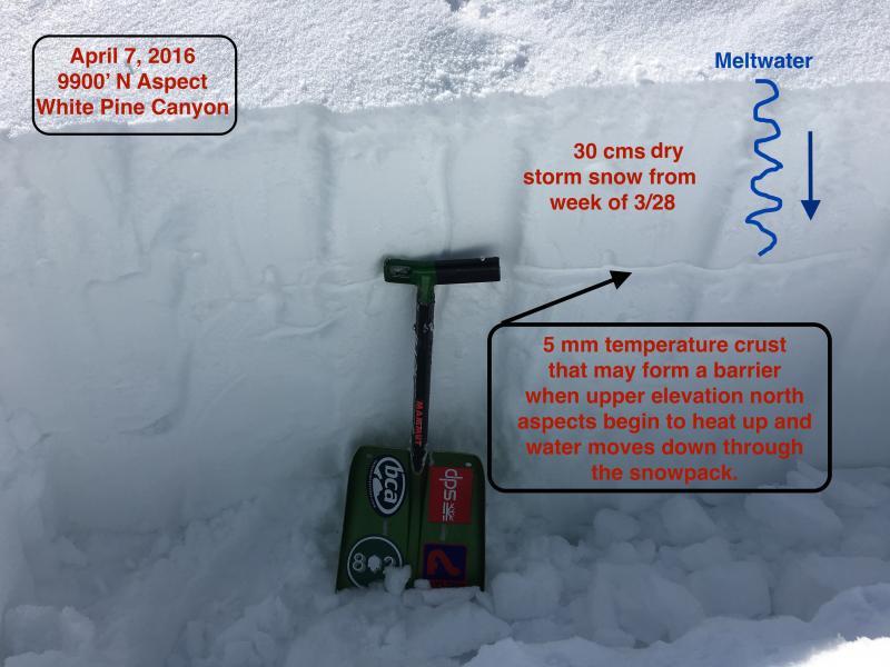
I am curious how upper elevation north aspects look as this is the only terrain that has not yet gone through a wet cycle this season. (Low and mid elevation north aspects got quite damp on a few occasions over the past few weeks due to warm temperatures and some greenhousing.) I am finding a temperature crust down about 30 cms, and as these upper north aspects continue to warm and water from melting snow begins to percolate down through the snowpack, it will be interesting to see if this temperature crust provides a barrier (where it then moves across the crust, increasing chances of wet slab activity) or down through the snowpack where it limits the chances of wet slab activity.