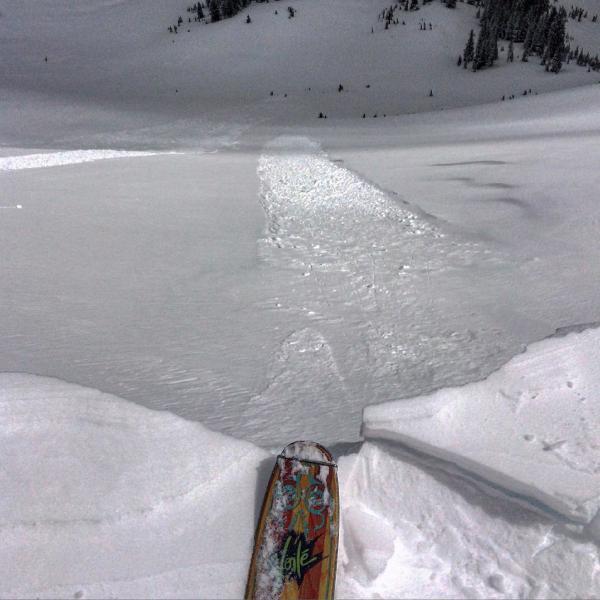
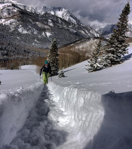
Headed up to West Monitor via Willow Heights thought the DP would already have a trail in but to my surprise they hadn't. Trail breaking was a bit of a labor today, mostly because of the depth and the density inversion at the bottom of the storm snow. Once we got to WM had already decided we were probably not going to ski it because the density inversion was creating a weak layer under the denser snow on top, and after noting a recent avalanche in the center mid slope, we decided to ski the S facing Hour Glass before the sun dampened it, the sun had already got to the steeper portion at the bottom and had dampened the surface, making the break out of there even more laborious. Decided to switch aspects to NW and skied Wills Hill which still had deep dry snow and was non wind affected. We did not encounter a lot of avalanche activity in our travels except the one in WM, but the density inversion kept us out of the steep N facing terrain. South will be crusted in the AM and I would suspect W will be too, I think N, NE survived the heat today but may be short lived tomorrow if the sun comes out.
Photos: cornice falls and sluffing in West Monitor, trench warfare breaking trail.
I would think any density inversions and wind slabs will most likely be settled out tomorrow, and the biggest concern will be wet activity on slick bed surfaces


