Observation: Mary Ellen

Observation Date
3/24/2016
Observer Name
Zimmerman-Wall
Region
Provo » American Fork » Mary Ellen Gulch
Location Name or Route
AF Canyon/Mary Ellen Gulch and Barussia
Weather
Sky
Broken
Wind Direction
West
Wind Speed
Light
Weather Comments
Sky coverage trended from Overcast to Broken and back to Overcast as the day went on. Around mid day, the thin cloud cover was holding in heat and some green housing was taking place. The winds had backed off signiciantly after sunrise and were light from the west north west most of the day. Trace amounts of light snow fell for about 20 mintues around lunch time.
Snow Characteristics
New Snow Depth
8"
New Snow Density
Medium
Snow Surface Conditions
Powder
Wind Crust
Damp
Snow Characteristics Comments
Snow surfaces and new snow depths varied significantly across both drainages of Mary Ellen Gulch and Lower Mineral Basin (5-30cm) West facing had seen its share of wind scouring right down to the old melt freeze. Lots of crossloading had taken place on Northerly facing slopes in exposed terrain. The Easts and Souths sported dense powder that was becoming damp by mid day. Best skiing was on solars before they warmed and the sheltered Northerly was smooth and sublime.
Red Flags
Red Flags
Wind Loading
Rapid Warming
Red Flags Comments
Strong winds were key concern over the last 24 hours and there was plenty of new snow for transport. However, the winds backed off enough to where drifting became less of an issue. Warming temps and short lived greenhousing made snow surfaces damp on many aspects by mid day.
Avalanche Problem #1
Problem
Wind Drifted Snow
Trend
Same
Problem #1 Comments
Certainly a notable problem since Wednesday, but trending towards less of an issue with abating winds during the day today. However, the forecast is calling for another ramp up in wind speed tonight and suspect that those drifts/wind slabs will become reactive again soon with new load.
Avalanche Problem #2
Problem
Wet Snow
Trend
Decreasing Danger
Problem #2 Comments

Saw evidence of wet loose (roller balls) on West and South facing below 9800 feet. These were small and started around rock bands. Greenhousing was certainly happening in MEG, but the light wind seemed to keep the snow from going off totally. [Forecaster Comments - Thanks Sean. Really appreciate the obs from AF!]

Comments
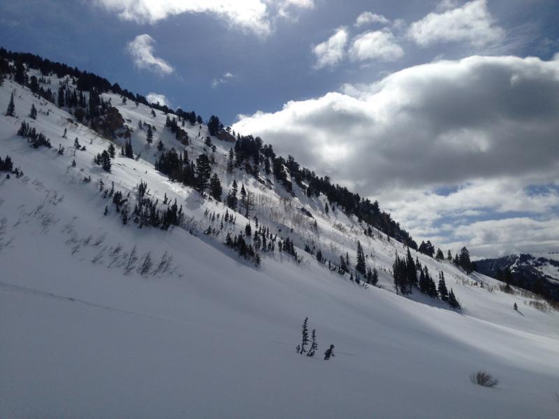
Photo of West facing Miller Hill, scouring is evidenced by the shiny patches lower on the slope.
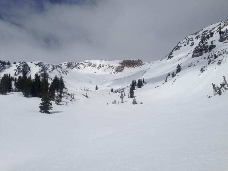
Looking up the MEG drainage. Notice cloud cover contributing to greenhousing.
Today's Observed Danger Rating
Moderate
Tomorrows Estimated Danger Rating
Moderate