
Story of the day were the sustained winds out of the west, affecting most mid and upper elevation aspects. Although many drifts have an easterly component, the way the winds have swirled drifts are found on all aspects, particularly at upper elevations. Also finding cornices are growing larger and continue to be sensitive.
For the most part, most of the wind drifts have settled out and are unreactive to ski cuts and cornice kicks, but I also did find a few fresh, shallow drifts that cracked out around my skis.
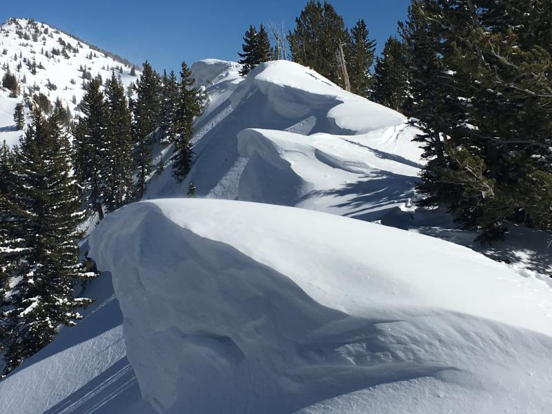
Photo shows large cornices along Silver Fork ridgeline.
Video showing drifting along 10K ridgelines from the Westerly winds.
This video shows my partner Dave Pease kicking fresh cornices along the Silver Fork ridgeline. Cornice kicking has been 5 star this week.
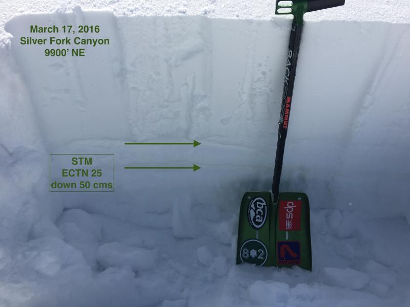
Also interested in looking at upper elevation North aspects. This pit shows 40 cms (16") storm totals sitting on top of 2 different heat crusts. Weak, faceted snow underneath the top crust was the likely weak layer in at least 1 natural avalanche from Cardiac Ridge overnight Tuesday. In this pit I was finding the weakest snow to be a layer of graupel below the lower heat crust down 50 cms (20").
Quite windy, so audio is very difficult to hear, but an overview of what we were finding today:
- sustained Westerly winds continue to drift snow at mid and upper elevations. Drifts are less sensitive today, but wind loading remains an avalanche problem for Friday, particularly at upper elevations.
- Cool temps and winds kept wet activity at bay today with only the surface of the snow dampening on south aspects. (Although I suspect that on some solar aspects sheltered from the winds wet activity may have been more prominent.
Fresh wind drifts will continue to be a concern for Friday, and wet activity will become a significant concern with rapid warming expected over the weekend.


