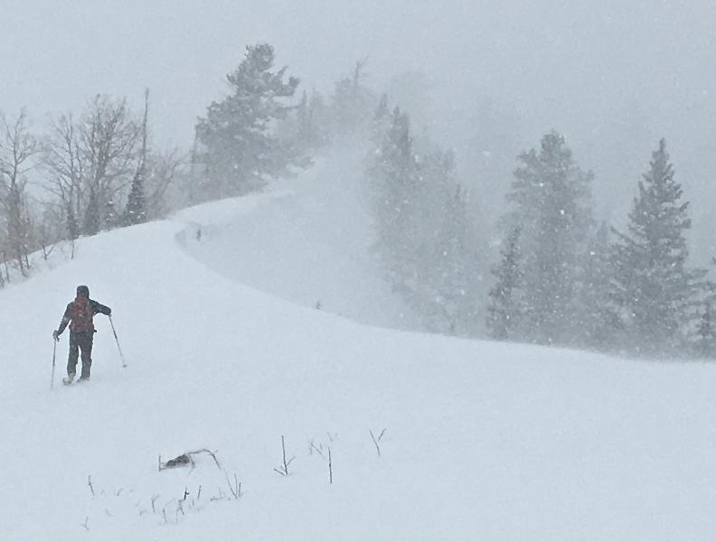
DEEP powder conditions! A bit over a foot of new snow since Tuesday, with significant ongoing accumulations and well over 5" of SWE storm total.
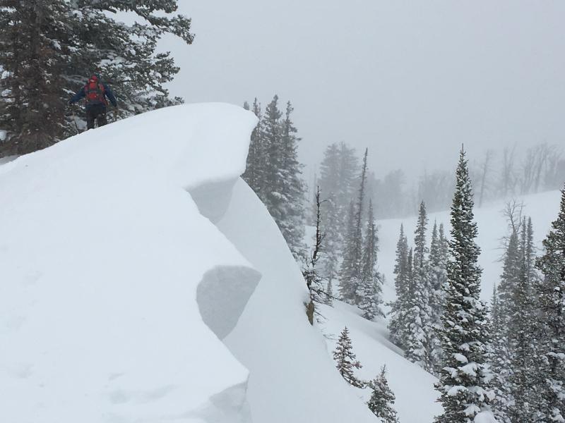
Noted some large cornice build up with this blustery and productive storm. These are known for breaking further back than expected and catching people traveling along ridge lines.
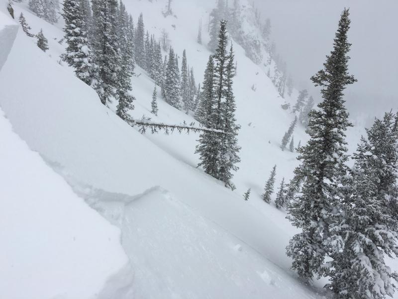
There are some very deep fresh deposits of stiffer drifted snow in exposed terrain. Wind slabs where continuing to form rapidly yesterday, and potential weak layers form with wind shifts or periods of calm(er) between loading sessions. I triggered a small wind slab with a cornice drop, and I'm sure potential for much larger activity exists in higher and more exposed terrain.
Read About Our History
Find an Avalanche Class
Read the forecast
Submit an Observation
View Our Calendar