Observation: Big Springs

Observation Date
2/28/2016
Observer Name
Wilson, Covington, Hardesty
Region
Provo » Provo Canyon » South Fork Provo R. » Big Springs
Location Name or Route
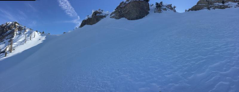
Big Springs Cascade Ridge
Weather
Sky
Few
Wind Direction
West
Wind Speed
Calm
Weather Comments
Warm afternoon--maybe 40s--but cooler both today and last night than the previous 24 hours. Crust remained supportable until mid morning and provided the perfect conditions for easy travel...until it didn't. No signs of snow transport by wind in our region.
Snow Characteristics
Snow Surface Conditions
Dense Loose
Faceted Loose
Wind Crust
Melt-Freeze Crust
Damp
Snow Characteristics Comments

Vignettes:

  • A ribbon of blue ice where a road cut collects meltwater.
  • the uptrack equivalent of "hero" snow: a slight softening on top of a board of supportable refreeze.
  • Punchy steps in thinner south facing snowpack, deeper stays generally supportable. large corn grains suggest numerous freeze cycles.
  • A tight ridge that forces stepping from wet snow to the south to drier snow to the north. Yes, snowballs on the skins.
  • Facets on a north slope, now damp, make for decent turns in sparse canopy.
  • Wind affected snow for 1000 vertical feet in the upper bowls shows beautiful patterning but no real slabs. 1-3 cm crust over slippery facets.
  • South facing low looks like summer.

Avalanche Problem #1
Problem #1 Comments

No red flags today.

As for wet activity, only one small loose slide seen on our tour. East aspect.

In regards to deep slabs, a pit in north facing suspected repeater showed moist, rounding basal facets. Also saw multiple tracks in steep (40 degree?) north facing terrain with some shallow rocks.

Snow Profile
Aspect
Northwest
Elevation
9,300'
Slope Angle
35°
Comments

Dug quick pits on northwest and south east slopes at 9300' to look for indications of wet loose and deep slab problems, respectively.

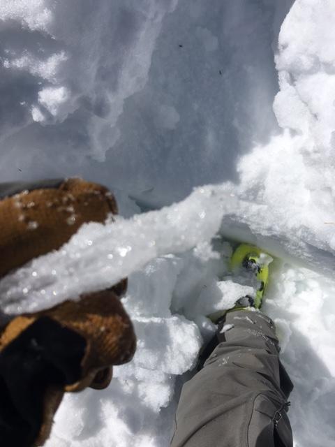
SE pit HS 130 cm with ice crusts at 70, 80, 85, 93 and 101 cm, ranging from .3 to 2.5 cm thick. Snow above the thick top crust is a variety of melt/freeze forms, but between and below the lower crusts the snow remains damp but not ripe. Relatively little free water traveling along density transitions within the snowpack.

NW pit HS 90 looks like repeater. Weakest snow was near surface facets down 10 cm; hardness of 4-finger minus with denser white snow above and denser sugary grey (mixed forms) below. Basal facets had been 3mm but now are moist and rounding where they weren't welded, although pockety loose areas exist. ECTN down 10.

Photos below:

Pretty wind jack and small cornices,

Single East facing wet loose,

A tree suggesting avalanches are real.

Today's Observed Danger Rating
Low
Tomorrows Estimated Danger Rating
Low
Coordinates