Observation Date
2/19/2016
Observer Name
Evelyn
Region
Salt Lake » Park City Ridgeline
Location Name or Route
USA Bowl to No Name to Willows
Weather
Sky
Few
Wind Direction
Southwest
Wind Speed
Moderate
Weather Comments
Clear in the morning, with high thin clouds coming in by late morning, clearing again late. Winds were calm low, gusty along the ridge lines. Warm T-shirt weather low and out of the wind, to quite cool along the windy ridge lines.
Snow Characteristics
New Snow Depth
4"
New Snow Density
High
Snow Surface Conditions
Dense Loose
Wind Crust
Rain-Rime Crust
Damp
Snow Characteristics Comments
Shallow, dense snow made for good turning on all aspects today, as soon as you were off the wind swept ridge lines. Tomorrow, at least southeast through west will be crusted. However, once it softens, may be ok, as it'll be damp snow on a supportable base. Mid and upper elevation shady slopes should still be good dense powder.
Ridges were scoured to rain/rime/sun crusts, sastrugi, hard wind board. People heading into the high alpine may want to consider some combo of axes/whippets/crampons/ski crampons.
Red Flags
Red Flags
Wind Loading
Red Flags Comments
Winds were still transporting snow thorugh mid day, though it seems they've just been blowing the same snow back and forth across the ridges. Didn't find any sensitive drifts, though didn't jump onto steeper wind drited slopes. No signs of any significant recent avalanches. A few rollar ball swarms/very small wet loose sluffs.
Avalanche Problem #1
Problem
Normal Caution
Trend
Decreasing Danger
Problem #1 Comments
Winds slabs: Assume a person could still trigger a wind slab on some steep, wind loaded slopes. Moderate again tomorrow.
Wet Loose: enough heating again tomorrow that wet loose sluffs could be pushed on steep sunny slopes, but limited snow available.
Normal Caution: stability increasing, and heading toward Low Danger in most terrain, over the next few days, with no storms in sight. New snow is mostly bonding well, and old snow has been pounded by wind and warm temperatures.
Comments
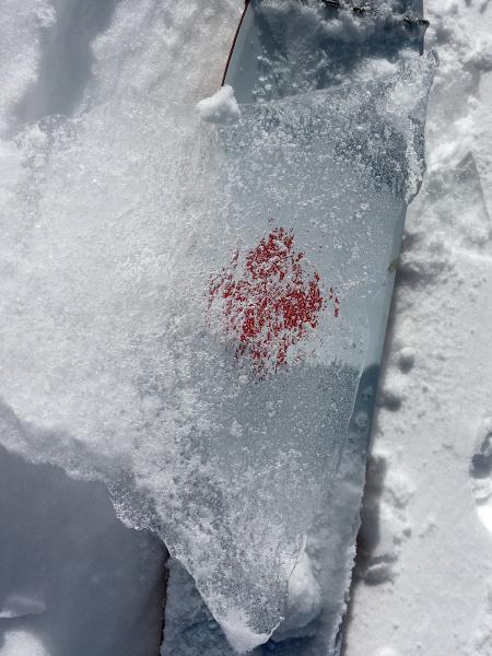
First photo - snow eroded down to clear ice in places along ridge. Rain crust?
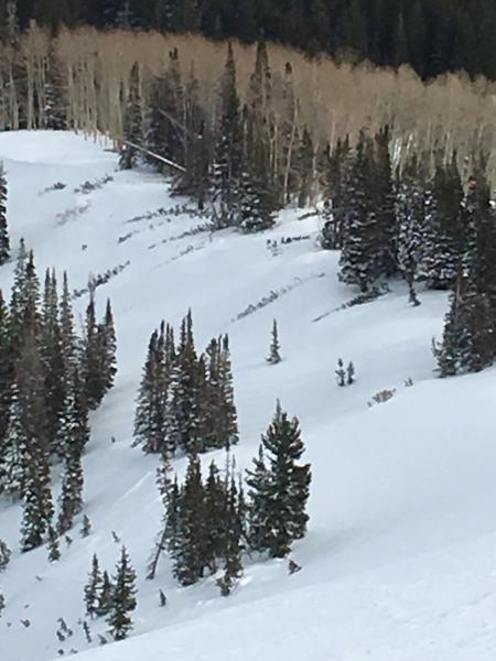
Second photo - looking down on ridge at a line of trees that were blown down yesterday. An impressive number of trees down along the road and in the backcountry.
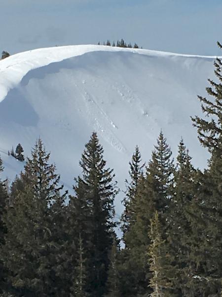
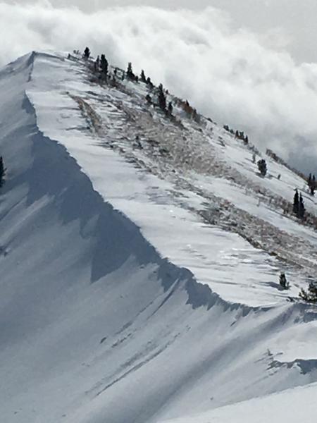
Really very few signs of natural avalanche activity - looked in No Name, No No Name, Radar Love, and the Monitors. Just a few small slides in South Monitor, that looked like they were triggered by new snow wind loading. A party kicked cornices in West Monitor, triggered a few slightly larger new snow slides.
Photo 2 - the usual cornices along ridge lines that could break back on to terrain that looks to be "flat".
Today's Observed Danger Rating
Moderate
Tomorrows Estimated Danger Rating
Moderate