Travel today was into upper White Pine. I made it as high as 10,800' in Glacier Bowl just underneath White Baldy. Was curious about two things today:
- the snowpack structure on solar aspects;
- the snow surface on mid and upper elevation north aspects.
Solar Aspects
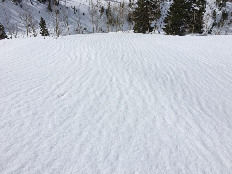
Even though mid elevations have largely stayed above freezing overnight (some for two nights), the snow surface was frozen on all aspects on my ascent. Dug a pit at 8700 on SW aspect. Evidence of drainage channels made it clear water has been running through the snowpack. As timing is everything with wet avalanche activity, I may have been looking a little too early in the day (about noon), but the snowpack was isothermal, and although I could identify several layers, it was obvious water was able to percolate freely through the snowpack with damp snow all the way to the ground. I could not get a shear at any layer in this 120 cm snowpack.
Generally found a snowpack structure that confirms why we have only been seeing wet loose avalanches, and not any wet slabs.
I exited the canyon about 2 pm, so things may have warmed up afterwards. And it may have been a different story in lower and mid elevation terrain shelterred from the winds, but from my perspective the winds were keeping the snow surface cool and likely put a lid on wet activity today.
Photo is of drainage channels. Video discussion of the snowpack on this SW aspect. (Though hope my high school AP Physics teacher - Mr. Michaud - never watches this as I say in the video "the snow turns to water". Snow is water! Should have said "Snow turns to liquid form". Boo.)
Upper Elevation North Aspects
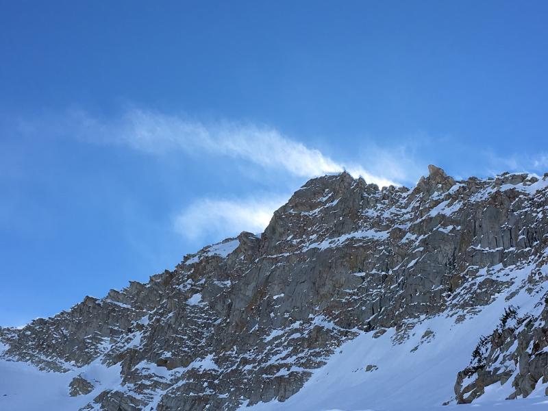
Also was interested in the snow surface on upper elevation north aspects. When I was out on Thursday I had noted what many others have as well this past week: the dry snow on upper elevation (and even some mid elevations) north aspects was weakening. The snow surface was turning to near surface facets and surface hoar. Mark White had been in upper White Pine on Tuesday and he noted the faceting was beginning to eat away at some old wind slabs. However, the winds today were affecting the snow surface and from what I noticed, the weak snow has largely been eroded by the sustained light to moderate winds. There were fresh P-hard wind pockets at well, but there really isn't much loose snow to move around to create larger, more widespread fresh drifts. Going forward am thinking this is good news as any snow that we (hopefully!) get in the upcoming week will not be falling on a weak snow surface at upper elevation north aspects, especially those in more open terrain that are likely to be affected by winds.
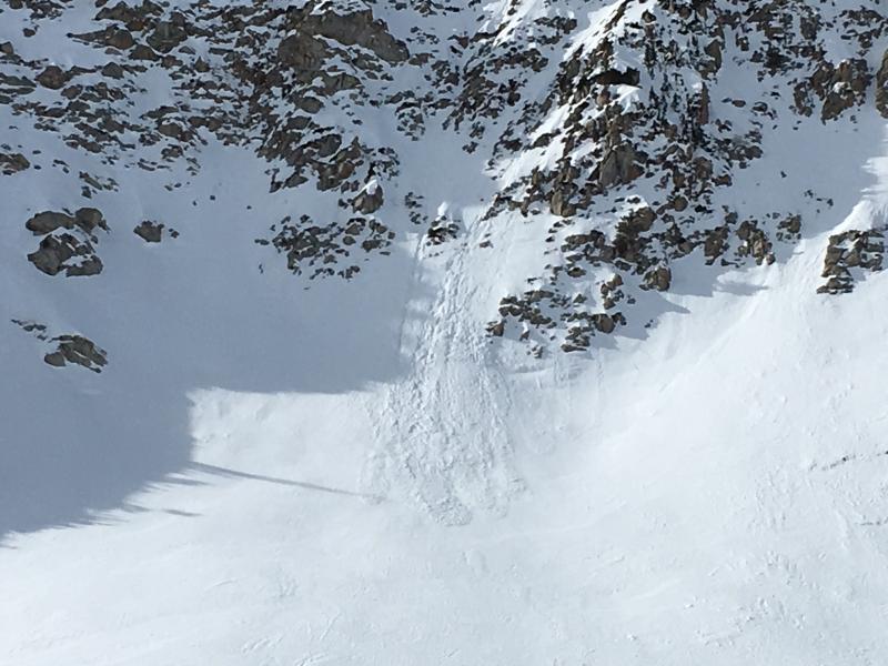
I did notice what appears to be a very small, but fresh dry snow avalanche on a steep east aspect off of White Baldy/Lake Peak ridgeline (photo). When I got a better view of it from higher up, it appears to have been a small, fresh wind pocket that pulled out naturally (somehow). Small class 1 avalanche, but evidence that the westerly winds may be creating some small wind pockets on north through east aspects at upper elevations.
Video discussion of upper elevation winds.
Video discussion of how terrain can channel winds creating drifting on unexpected aspects.


