Observation: Red Baldy

Observation Date
2/5/2016
Observer Name
Wilson, Hardesty
Region
Salt Lake » Little Cottonwood Canyon » White Pine » Red Baldy
Location Name or Route
White Pine, Red Baldy
Weather
Sky
Clear
Weather Comments
Calm air, sunny blue skis, clinging cloud layers under the peaks. Wow.
Snow Characteristics
New Snow Depth
7"
Snow Surface Conditions
Powder
Wind Crust
Damp
Snow Characteristics Comments

Light new snow—perhaps the last for a while—was wind affected only in the upper reaches of White Pine, particularly on ridges and open, high-elevation subridges. Rime on the trees, with an outer layer of large surface hoar, suggested moisture in the air and a wind that died down nearly completely. Everywhere else—fantastic!

In upper White Pine we felt dampening of snow on West aspects but warmer temps and didn't have much impact on stability. Some D1 wet loose where there'd been warming and dry loose point releases around the compass, especially on steep slopes under rock bands. Small crowns(6"x35') from 4 natural (wind?) slabs visible along Red Baldy ridgeline into Blue Ice of Silver Creek. Cornice development could be a player for ascending some of the steep shots in the area.

As for buried structure, the rain crust 40cm down at 7800' was nearly 3 cm thick with some SH frozen into it underneath, but no propagation in ECTs..just failure beneath the crust. The crust wasn’t noted in a similarly unreactive pit at 8800’. Otherwise, snowpack transitioned from light (fist) new snow to strong and hard (pencil) old snow about 1.2 meters down in a reassuringly right-side-up manner in White Pine.

Still, we adjusted our route to minimize unnecessary exposure on our way over Red Baldy: ascending the shoulder adjacent to Rock & Roll, traversing east, and scooting down the ridge skiers right of Red Baldy run for a few hundred feet before entering.

Snow Profile
Aspect
North
Slope Angle
37°
Comments

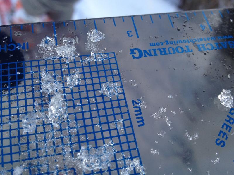
Dug test pit at 7800 NNW to look for weakness around last week’s rain crust. Photos show size/development of crystals below the layer, but stability didn’t seem compromised. Aside from rough localized fractures in the new, ECTN 23 x2 below the melt freeze crust were the only results. No action in WNW 8800 pit either. Note that these pits looked at the top 1.2 of snow only.

Small point release avalanches near rock bands.

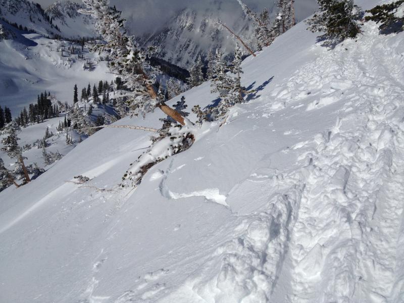
Small crown (more further out along ridge), perhaps from wind slabs?

Crack on a wind pillow--localized. .

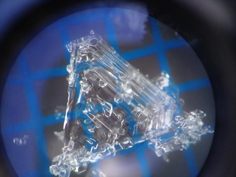
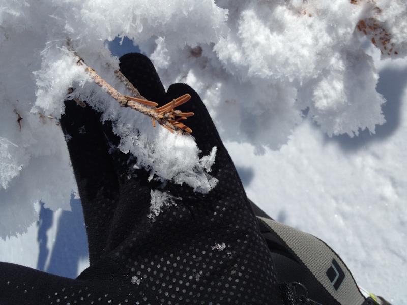
Rime and texture suggest moisture and NW wind up top, but nearby large SH crystals speak to calm recent and current conditions.

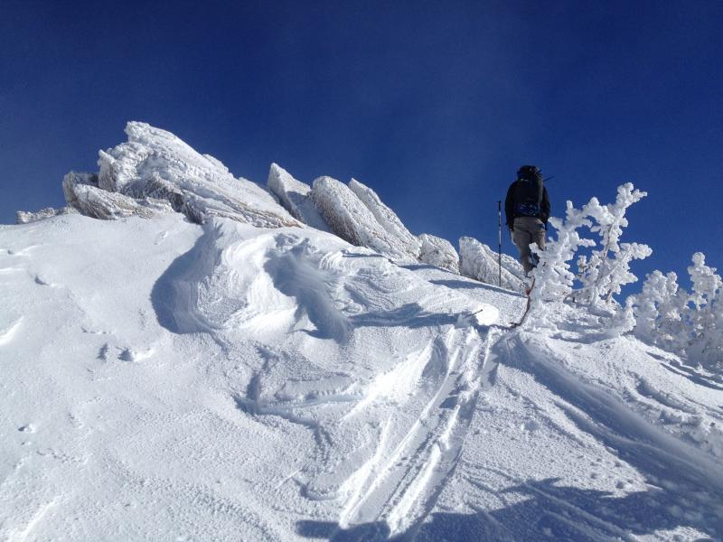
Cool 5-second clip showing how an air mass descends again after being forced up and over a pass.

Today's Observed Danger Rating
Moderate
Tomorrows Estimated Danger Rating
Moderate
Coordinates