Observation: Cardiff Pass

Observation Date
1/30/2016
Observer Name
Tyler Falk
Region
Salt Lake » Little Cottonwood Canyon » Cardiff Pass
Location Name or Route
Cardiff Pass
Weather
Sky
Obscured
Precipitation
Moderate Snowfall
Wind Direction
Northwest
Wind Speed
Calm
Weather Comments
Moderate to heavy snowfall at times in the afternoon. Not too much wind off the ridgelines.
Snow Characteristics
New Snow Depth
12"
New Snow Density
Medium
Snow Surface Conditions
Powder
Dense Loose
Snow Characteristics Comments

The storm seamed to start out with Grapuel and heavier snow which made the storm right side up with the lighter snow falling in the afternoon. About a foot of new snow in my travels today. Not as much energy in my ECT's and PST's as I expected, with resistant type failures. Seams like this is they type of situation that we are currently in with high spacial variability and possibly needing to hit that right weak spot to have the slope fail. For example the the Holy Toledo slide when Drew noted that ECTP17 Q1 on flank, tried again 10 ft over w/ no result." This speaks to the variability of the snow pack this year.

Red Flags
Red Flags
Recent Avalanches
Heavy Snowfall
Wind Loading
Cracking
Poor Snowpack Structure
Red Flags Comments
High PI rates, likely at least 2" of water weight, and snow avilable for transport were the major red flags that I saw today. Minor cracking and a possible collapse noticed aswell.
Avalanche Problem #1
Problem
New Snow
Trend
Same
Problem #1 Comments

The foot or so of new snow seamed to want to move fairly easily especially in areas with slick crusts below. Seamed possible for the new snow to step down deeper into other layers of the snow pack with a large enough storm slab. Sluffs and loose snow were running far today. Little superior seamed to go almost full track. Likely UDOT this am.

Avalanche Problem #2
Problem
Persistent Weak Layer
Trend
Same
Problem #2 Comments

High consequence slides can still occur most likely where they have already slid this year. Visibility limited what we could see today but I wouldn't be shocked if we see a few natural deeper slabs pulling out tomorrow when the weather clears out a bit that ran during the height of instability today.

Comments

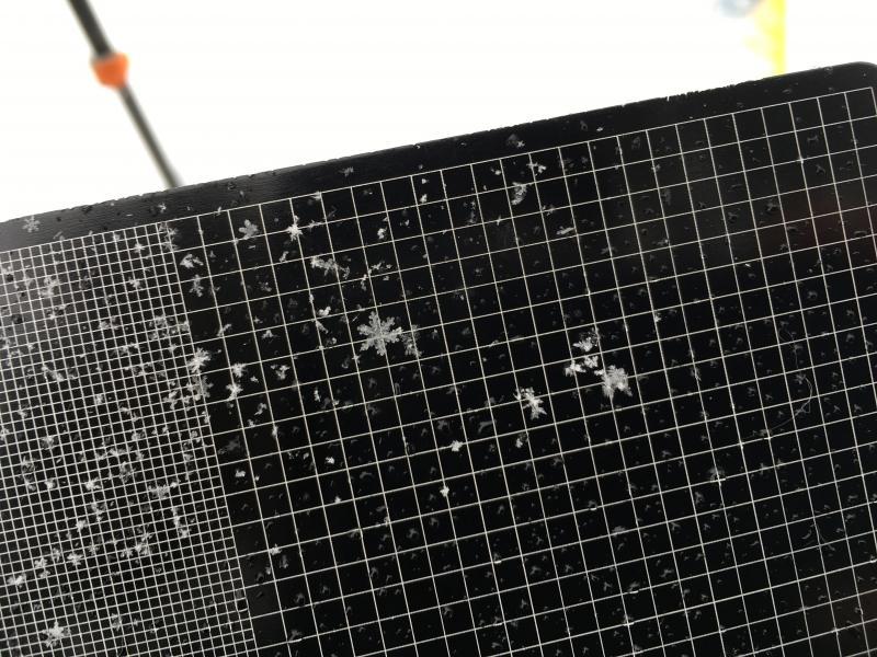
Pic 1. Mixed Precip Particles including a 5mm Stellar on 3mm grid on the right side.

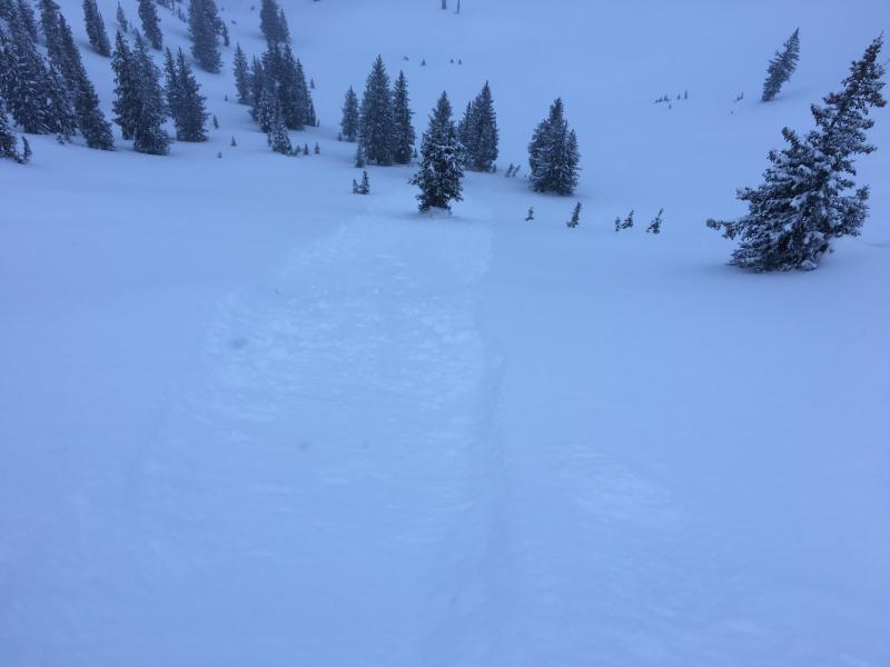
Pic 2. The new loose snow running far.

Today's Observed Danger Rating
High
Tomorrows Estimated Danger Rating
Considerable