Observation Date
1/29/2016
Observer Name
Ted Scroggin
Region
Uintas » Bear River Ranger District » Whitney Basin
Location Name or Route
Whitney Basin
Weather
Sky
Clear
Wind Direction
Southwest
Wind Speed
Moderate
Weather Comments
A clear start to the day with high clouds moving in early afternoon, followed by lowering clouds, some light snow fall and gusty southwest ridge top winds.
Snow Characteristics
Snow Surface Conditions
Dense Loose
Faceted Loose
Snow Characteristics Comments
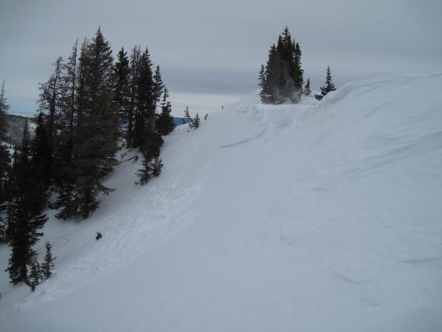
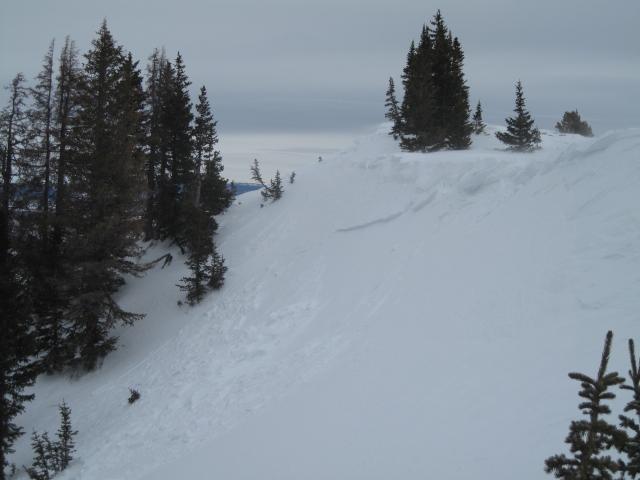
In the exposed wind areas, the snow was beginning to stiffen and slab-up, but once out of the wind, snow conditions remain quite good in sheltered terrain.
Red Flags
Red Flags
Wind Loading
Cracking
Red Flags Comments
Spent a few hours up in the wind zone this afternoon, observing lots of snow being moved around along the ridge lines. Moderate to strong southwest winds were forming shallow and manageable wind slabs early in the afternoon, but by days end I would imagine these are getting a bit deeper and wider on the north through east facing slopes.
Avalanche Problem #1
Problem
Wind Drifted Snow
Trend
Increasing Danger
Problem #1 Comments
Today's steady gusty winds and forecasted storm with a strong cold front moving in, these wind slabs will be much deeper and not so manageable tomorrow.
Avalanche Problem #2
Problem
Persistent Weak Layer
Trend
Increasing Danger
Problem #2 Comments
Looking at the forecasted water amounts, many slopes with buried faceted weak layers could easily become overloaded and avalanche naturally.
Comments
This afternoon I was finding these fresh shallow wind slabs along the high ridgelines that face north through northeast. They did need a little prodding with a small chunk of snow dropped on the slope. These were manageable in size at the time, but by the end of the day I would imagine they were getting deeper and wider.
Today's Observed Danger Rating
Moderate
Tomorrows Estimated Danger Rating
Considerable