Observation Date
1/17/2016
Observer Name
Toddeo
Region
Salt Lake » Big Cottonwood Canyon » Mill A
Location Name or Route
Mill A
Weather
Sky
Scattered
Wind Speed
Light
Weather Comments
Generally calm after about noon. Warm enough for some heating on mid and upper elevations souths. Rollerballs on sunny south aspects below about 7800'.
Snow Characteristics
New Snow Depth
8"
New Snow Density
Medium
Snow Surface Conditions
Powder
Dense Loose
Wind Crust
Melt-Freeze Crust
Damp
Snow Characteristics Comments
8" from the last couple of storms in this area, hard to tell exactly from winds even down low in Mill A. Mostly what I would call dense powder. Upper 2-3" were dense and inverted. Trail breaking was a bit of work.
Many south aspects will have a crust tomorrow, SE aspects holding up a bit better. Wind crusts/slabs in exposed areas and some in sheltered areas as well.
Red Flags
Red Flags
Wind Loading
Cracking
Poor Snowpack Structure
Red Flags Comments
Observed some wind transport/loading on higher ridges this morning. We found wind slabs in areas well off of the ridge tops on northerly aspects. Upper Mill A looked blasted by the wind.
All cracking was localized, no shooting cracks observed. Northerly aspects still contain basal facets.
With the inverted snow and wind affect, I was surprised by the lack of in-your-face red flags such as collapsing and shooting cracks.
Avalanche Problem #1
Problem
Wind Drifted Snow
Trend
Same
Problem #1 Comments
Wind slabs were my primary concern today, we stuck to generally sheltered terrain, but did observe wind slabs on north aspects (see photo below). Some of these were fairly reactive in quick columns/ECTPs (e.g. ECTP1 Q2 at 12") but on a localized scale. I cut a couple of drifts on the Mill A ridge without results. I would imagine that it might be a different story in the alpine.
Localized moderate to perhaps considerable in areas traveled today
Avalanche Problem #2
Problem
Persistent Weak Layer
Trend
Same
Problem #2 Comments
Basal facets still lurking,.....
Low to moderate danger.
Snow Profile
Aspect
East
Elevation
8,600'
Slope Angle
25°
Comments
EEN would be my best guess for the true aspect of the snow profile .
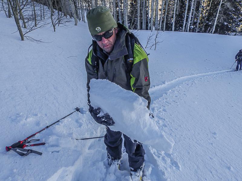
Photo below, wind slab in Mill A, north aspect. These were failing at easy in columns and ECTP 1, Q2 at 8-14" depths in this area. Note, this is only 150' away from my snow profile on an EEN aspect that was ECTN, This highlights the variable nature of the current upper snow pack.
Hazard is a tough call and very variable. I would say moderate in wind sheltered areas and considerable in wind affected areas. All of the potential hazard we observed was in the upper snow pack.
Today's Observed Danger Rating
Considerable
Tomorrows Estimated Danger Rating
Considerable