Observation Date
1/16/2016
Observer Name
Ted Scroggin
Region
Uintas » Bear River Ranger District » Gold Hill
Location Name or Route
Gold Hill Basin
Weather
Sky
Obscured
Wind Direction
Northwest
Wind Speed
Moderate
Weather Comments
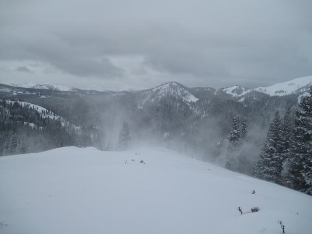
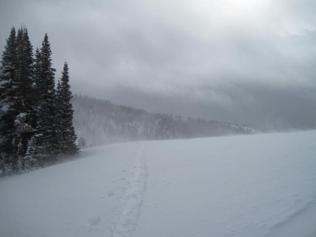
Mostly cloudy with brief periods of filtered sunshine and moderate to strong west and northwest winds.
Snow Characteristics
New Snow Depth
16"
New Snow Density
Low
Snow Surface Conditions
Powder
Snow Characteristics Comments
While the trailhead has only being getting minor amounts of new snow the last few days, the high country did very well with a solid 16-18" that has accumulated with these small weather systems that move through. Today's snow was nice light density and riders were tearing it up enjoying great riding, while those out looking for turns were treated to chin tickling conditions on fun low angle slopes.
Red Flags
Red Flags
Wind Loading
Cracking
Red Flags Comments
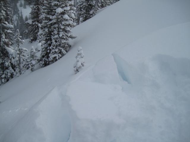
The moderate to strong west and northwest winds were the big red flag today combined with the new snow. I did not observe much in the way of natural avalanche activity and I think the new snow had just not developed into enough of a slab yet. As the afternoon went on however, the winds became more gusty and things were quickly changing and likely the slab was getting more consolidated.
Avalanche Problem #1
Problem
Wind Drifted Snow
Trend
Increasing Danger
Problem #1 Comments
Stomping around the Gold Hill ridge line, the wind slabs were breaking at my skis and around two feet deep, but they were not overly sensitive and did not want to move much. This was in the morning, but by late afternoon when the winds became gusty and strong the conditions were quickly changing.
Avalanche Problem #2
Problem
Persistent Weak Layer
Trend
Increasing Danger
Problem #2 Comments
With these series of storms, this might be enough weight to overload the weak sugary snow near the ground, mainly in the shallow snow pack areas.
Comments
Lots of wind today and lots of new snow to blow around. The west and northwest winds were transporting snow onto the east through southeast facing slopes creating large rounded pillows of wind drifted snow.
The fresh wind slabs along the high ridge lines were cracking a couple of feet deep and just around a persons skis or sled, but they did not want to move much early in the day. This was quickly changing as the afternoon went on and the winds became more gusty.
Moderate to strong west winds were cranking through the Gold Hill Pass later in the afternoon, quickly filling in my tracks as I was returning to my sled.
Today's Observed Danger Rating
Considerable
Tomorrows Estimated Danger Rating
Considerable